18th Century map of the Qing Empire
Numéro d’image : 11591800
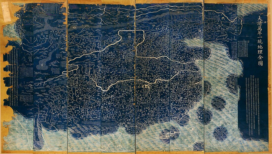
| 18th Century map of the Qing Empire. Historical Chinese map showing the mountains,rivers,coasts,territory and administrative divisions of the Qing Empire,along with a distorted view of the surrounding countries. Dark blue is land and light blue is sea. The title of this woodcut print translates as 'Universal map of the Qing Empire'. It covers the area from Korea (far right) to the Pamir Mountains (far left). And from the Heilong Jiang (Amur) river (top) to the islands of the South China Sea (bottom). This is a revised edition of a map originally drawn by Huang Qianren in 1767 | |
| Licence : | Droits gérés |
| Crédit: | Science Photo Library / Library of Congress |
| Taille de l’image : | 7030 px × 3992 px |
| Model Release : | Non requis |
| Property Release : | Non requis |
| Restrictions : | - |
Prix pour cette image À partir de 45 €
Produit vendu
(Calendrier, Carte postale, Carte de vœux, Impression sur textile, Packaging etc)
À partir de 45 €
Usage commercial
(Affichage, Annonce presse, Annonce TV, Carte, Digital - hors rés. sociaux, Digital - rés. sociaux etc)
À partir de 45 €
Éditorial
(Digital, Journal, Livre, Livre pratique, Magazine, Télévision etc)
À partir de 60 €
Usage non-commercial
(Digital - hors rés. sociaux, Digital - rés. sociaux etc)
À partir de 120 €
Mots clés
- 1700,
- 1767,
- 18ème siècle,
- asiatique,
- Asie,
- bleu,
- bois coupé,
- carte,
- cartographie,
- chinois,
- Corée,
- côte,
- côtes,
- côtier,
- coupe de bois,
- géographie,
- géographique,
- gravure sur bois,
- île,
- îles,
- illustration,
- mer,
- mer de Chine du sud,
- mer de Chine méridionale,
- montagnes,
- oeuvre,
- pays,
- rivages,
- rivière,
- rivières,
- territoire,
- XVIIIème siècle