Iraq,satellite image
Numéro d’image : 11590598
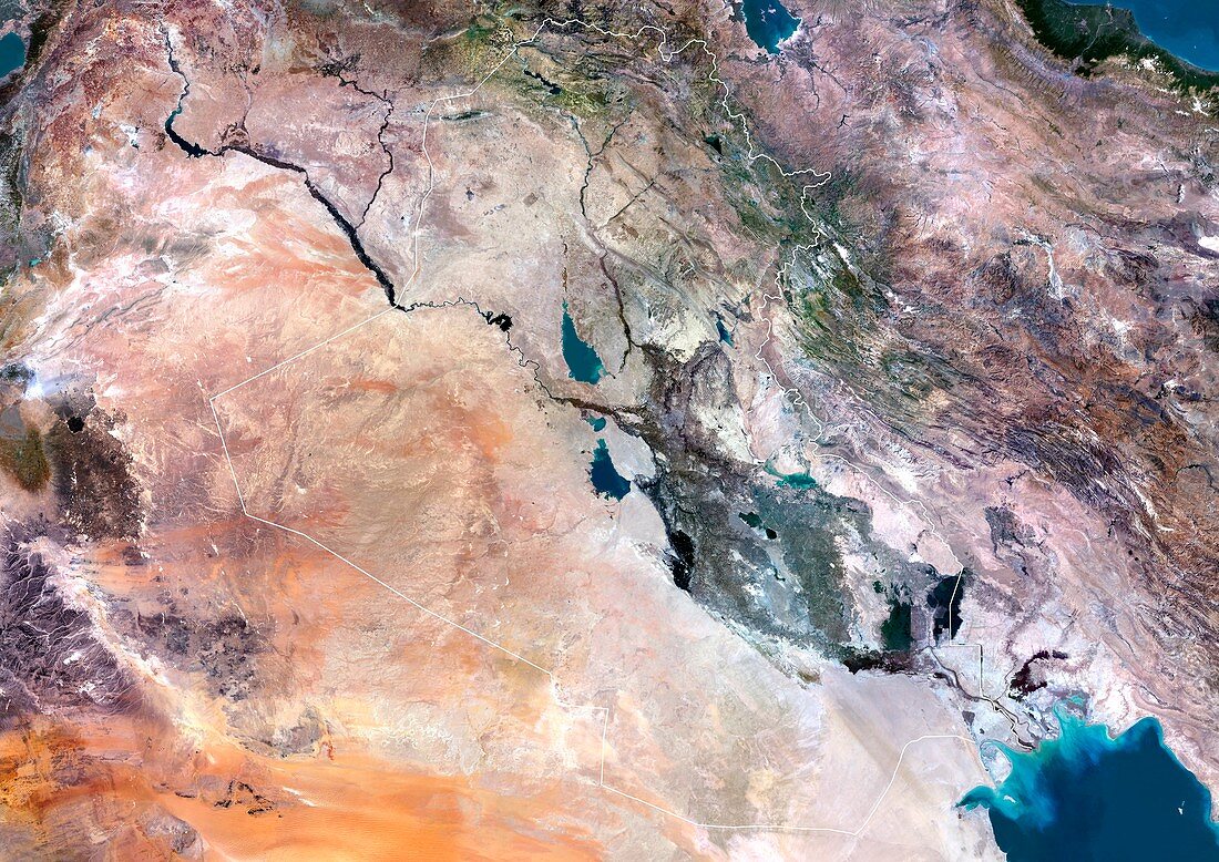
| Irag,satellite image. Iraq's border is shown in white. North is at top. The green area in the east of the country is fertile land between the Tigris river (upper river) and Euphrates river (lower river). The Persian Gulf is at bottom right. Composite image from Landsat 5 and 7 satellites | |
| Licence : | Droits gérés |
| Crédit: | Science Photo Library / Planetobserver |
| Taille de l’image : | 4969 px × 3514 px |
| Model Release : | Non requis |
| Property Release : | Non requis |
| Restrictions : | - |
Prix pour cette image À partir de 45 €
Produit vendu
(Calendrier, Carte postale, Carte de vœux, Impression sur textile, Packaging etc)
À partir de 45 €
Usage commercial
(Affichage, Annonce presse, Annonce TV, Carte, Digital - hors rés. sociaux, Digital - rés. sociaux etc)
À partir de 45 €
Éditorial
(Digital, Journal, Livre, Livre pratique, Magazine, Télévision etc)
À partir de 60 €
Usage non-commercial
(Digital - hors rés. sociaux, Digital - rés. sociaux etc)
À partir de 120 €
Mots clés
- aperçu,
- aride,
- aridité,
- contour,
- couleur vraie,
- de l'espace,
- désert,
- eau,
- esquisser,
- Euphrate,
- fertile,
- frontière,
- géographie,
- géographique,
- Golfe Persique,
- image satellite,
- Irak,
- irakien,
- Landsat 5,
- landsat 7,
- mésopotamie,
- Moyen Orient,
- Moyen-Orient,
- observation de la terre,
- pays,
- rivière,
- rivières,
- satellite,
- sec,
- tigre,
- vraie couleur