Iberian peninsula,satellite image
Numéro d’image : 11590568
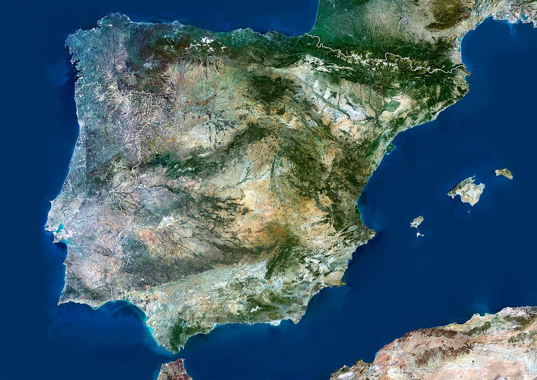
| Iberian peninsula. Satellite image of the Iberian peninsular showing Spain's borders with Portugal (left) and France (top right). At right are the Balaeric Islands,which are a province of Spain. At left is the Atlantic Ocean,at right the Mediterranean Sea. Composite image from Landsat 5 and 7 satellites | |
| Licence : | Droits gérés |
| Crédit: | Science Photo Library / Planetobserver |
| Taille de l’image : | 4969 px × 3514 px |
| Model Release : | Non requis |
| Property Release : | Non requis |
| Restrictions : | - |
Prix pour cette image À partir de 45 €
Produit vendu
(Calendrier, Carte postale, Carte de vœux, Impression sur textile, Packaging etc)
À partir de 45 €
Usage commercial
(Affichage, Annonce presse, Annonce TV, Carte, Digital - hors rés. sociaux, Digital - rés. sociaux etc)
À partir de 45 €
Éditorial
(Digital, Journal, Livre, Livre pratique, Magazine, Télévision etc)
À partir de 60 €
Usage non-commercial
(Digital - hors rés. sociaux, Digital - rés. sociaux etc)
À partir de 120 €
Mots clés
- aperçu,
- contour,
- côte,
- couleur vraie,
- Espagne,
- espagnol,
- esquisser,
- Europe,
- européen,
- frontière,
- frontières,
- géographie,
- géographique,
- île,
- Iles Baléares,
- image satellite,
- Landsat 5,
- landsat 7,
- littoral,
- Mer Méditérrannée,
- observation de la terre,
- Océan Atlantique,
- pays,
- pénisule Ibérique,
- Portugal,
- satellite,
- vraie couleur