Mississippi Delta,satellite image
Numéro d’image : 11589010
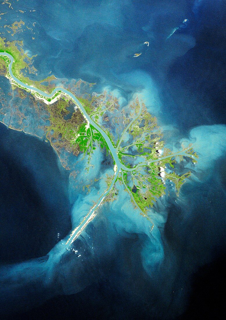
| Mississippi Delta. True colour Landsat satellite image of the Mississippi River Delta,Louisiana,USA. North is at top. The Mississippi River is seen running from top left into the Gulf of Mexico at bottom left. A delta is an area of sedimentation (deposition) at the mouth of a river. It is transitory and new channels are constantly forming while others become blocked. Image taken on 9th April 1976 | |
| Licence : | Droits gérés |
| Crédit: | Science Photo Library / Planetobserver |
| Taille de l’image : | 3520 px × 4978 px |
| Model Release : | Non requis |
| Property Release : | Non requis |
| Restrictions : | - |
Prix pour cette image À partir de 45 €
Produit vendu
(Calendrier, Carte postale, Carte de vœux, Impression sur textile, Packaging etc)
À partir de 45 €
Usage commercial
(Affichage, Annonce presse, Annonce TV, Carte, Digital - hors rés. sociaux, Digital - rés. sociaux etc)
À partir de 45 €
Éditorial
(Digital, Journal, Livre, Livre pratique, Magazine, Télévision etc)
À partir de 60 €
Usage non-commercial
(Digital - hors rés. sociaux, Digital - rés. sociaux etc)
À partir de 120 €