West Mata underwater volcano,altimetry
Numéro d’image : 11584512
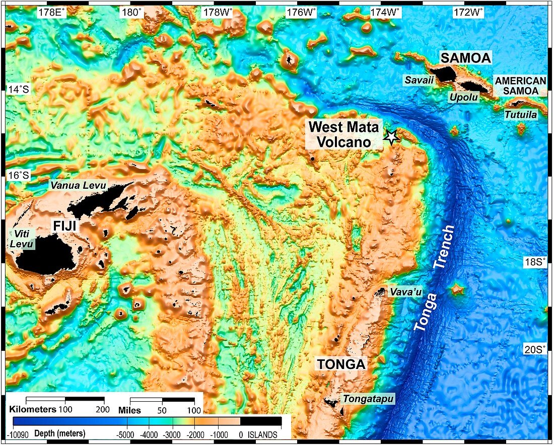
| West Mata underwater volcano. Altimetric map of the bed of the northeast Lau Basin in the south Pacific Ocean showing the West Mata volcano. West Mata was discovered in May 2009 and is the deepest erupting volcano yet discovered. It lies 4000 feet (1.2 kilometres) below the surface of the Pacific Ocean,in an area bounded by Fiji,Tonga and Samoa. Altimetric maps show the relative heights/depths of geographic features,here it shows the shape of the sea floor | |
| Licence : | Droits gérés |
| Crédit: | Science Photo Library / NOAA |
| Taille de l’image : | 4705 px × 3780 px |
| Model Release : | Non requis |
| Property Release : | Non requis |
| Restrictions : |
|
Prix pour cette image À partir de 45 €
Produit vendu
(Calendrier, Carte postale, Carte de vœux, Impression sur textile, Packaging etc)
À partir de 45 €
Usage commercial
(Affichage, Annonce presse, Annonce TV, Carte, Digital - hors rés. sociaux, Digital - rés. sociaux etc)
À partir de 45 €
Éditorial
(Digital, Journal, Livre, Livre pratique, Magazine, Télévision etc)
À partir de 60 €
Usage non-commercial
(Digital - hors rés. sociaux, Digital - rés. sociaux etc)
À partir de 120 €
Mots clés
- 2009,
- 21ème siècle,
- altimètre,
- avec code couleur,
- code couleur,
- codé par couleur,
- fidjiens,
- FIJI,
- géographie,
- géographique,
- géologie,
- géologique,
- hauteur,
- Océan Pacifique,
- oceania,
- Océanie,
- Pacifique Sud,
- par code couleur,
- plus profond,
- profondeur,
- Samoa,
- sommet,
- sous l'eau,
- sous marin,
- sous-marin,
- taille,
- Tonga,
- tongane,
- topographie,
- topographique,
- volcanique,
- vulcanologie,
- XX1ème siècle