Haiti,Caribbean,satellite image
Numéro d’image : 11568499
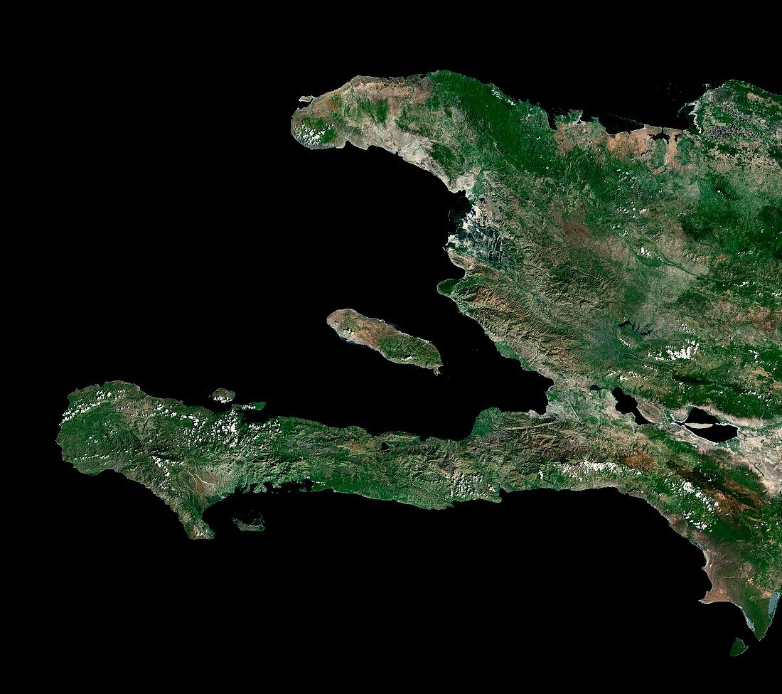
| Haiti. Satellite image of the Republic of Haiti on the island of Hispaniola in the Caribbean. North is at top. Hispaniola is divided into the Republic of Haiti to the west,and the Dominican Republic to the East. Forested areas are dark green,bare ground is brown,urban areas are grey,and water is black. The Haitian capital,Port-au-Prince (grey),can be seen at the eastern end of the large bay (centre). A major transition fault line (horizontal green line) can be seen running through the mountains just south-west of the capital. Image created using NaturalVue data obtained from the Landsat satellite | |
| Licence : | Droits gérés |
| Crédit: | Science Photo Library / MDA Information Systems |
| Taille de l’image : | 5500 px × 4878 px |
| Model Release : | Non requis |
| Property Release : | Non requis |
| Restrictions : | - |
Prix pour cette image À partir de 45 €
Produit vendu
(Calendrier, Carte postale, Carte de vœux, Impression sur textile, Packaging etc)
À partir de 45 €
Usage commercial
(Affichage, Annonce presse, Annonce TV, Carte, Digital - hors rés. sociaux, Digital - rés. sociaux etc)
À partir de 45 €
Éditorial
(Digital, Journal, Livre, Livre pratique, Magazine, Télévision etc)
À partir de 60 €
Usage non-commercial
(Digital - hors rés. sociaux, Digital - rés. sociaux etc)
À partir de 120 €
Mots clés
- Amérique du Nord,
- bois,
- capital,
- côte,
- côtier,
- couleur naturelle,
- créole,
- de l'espace,
- eau,
- ENRIQUILLO,
- forêt,
- forêts,
- géographie,
- géographique,
- géophysique,
- Haïti,
- haïtien,
- Hispaniola,
- image satellite,
- Landsat,
- littoral,
- Mer des Caraïbes,
- montagne,
- montagnes,
- montagneux,
- NASA,
- observation de la terre,
- région boisée,
- satellite,
- séismique,
- tremblement de terre,
- urbain,
- végétation,
- ville