Washington DC,USA,satellite image
Numéro d’image : 11566643
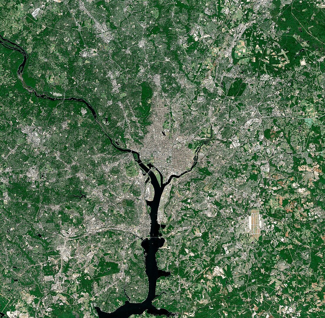
| Washington DC,USA. Satellite image of the city of Washington DC,the capital of the US. North is at top. Washington DC is officially named the District of Columbia and is located on the north bank of the Potomac River. It is bordered by the states of Virginia and Maryland. Forested areas are dark green,bare ground is brown,urban areas are grey,and water is black. Image created using NaturalVue data obtained from the Landsat 7 satellite | |
| Licence : | Droits gérés |
| Crédit: | Science Photo Library / MDA Information Systems |
| Taille de l’image : | 4244 px × 4157 px |
| Model Release : | Non requis |
| Property Release : | Non requis |
| Restrictions : | - |
Prix pour cette image À partir de 45 €
Produit vendu
(Calendrier, Carte postale, Carte de vœux, Impression sur textile, Packaging etc)
À partir de 45 €
Usage commercial
(Affichage, Annonce presse, Annonce TV, Carte, Digital - hors rés. sociaux, Digital - rés. sociaux etc)
À partir de 45 €
Éditorial
(Digital, Journal, Livre, Livre pratique, Magazine, Télévision etc)
À partir de 60 €
Usage non-commercial
(Digital - hors rés. sociaux, Digital - rés. sociaux etc)
À partir de 120 €
Mots clés
- américain,
- Amérique du Nord,
- bois,
- capital,
- couleur naturelle,
- D.C,
- D.C.,
- de l'espace,
- eau,
- Etats-Unis,
- fleuve Potomac,
- forêt,
- forêts,
- géographie,
- géographique,
- image satellite,
- landsat 7,
- métropolitain,
- N/A,
- NASA,
- observation de la terre,
- région boisée,
- rivière,
- rivière Potomac,
- satellite,
- urbain,
- urbanisation,
- US,
- USA,
- végétation,
- ville,
- Washington DC