Prehistoric sea level map,Europe
Numéro d’image : 11565983
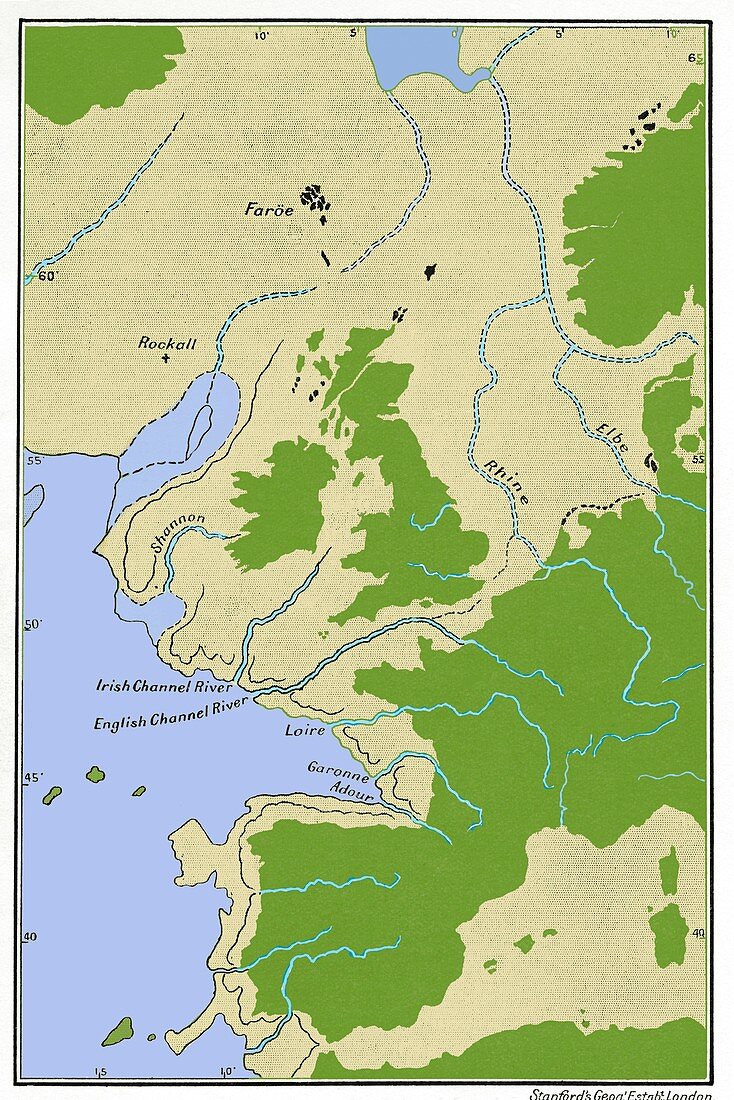
| Prehistoric sea level map. Published in 1913,this map shows changes in rivers and drainage patterns with sea level changes in Western Europe in prehistoric times (40,000 to 100,000 years ago). The map shows existing land masses (green) together with land masses which existed when sea levels were much lower than now (light green). At such times the rivers (blue) flowed across grassy plains now covered by sea. Sea levels are linked to periods of glaciation when much of the Earth's water is frozen to make glaciers,resulting in a drop in sea levels. Map from the 1913 edition of Prehistoric Times (Sir John Lubbock) | |
| Licence : | Droits gérés |
| Crédit: | Science Photo Library / Terry, Sheila |
| Taille de l’image : | 3425 px × 5134 px |
| Model Release : | Non requis |
| Property Release : | Non requis |
| Restrictions : | - |
Prix pour cette image À partir de 45 €
Produit vendu
(Calendrier, Carte postale, Carte de vœux, Impression sur textile, Packaging etc)
À partir de 45 €
Usage commercial
(Affichage, Annonce presse, Annonce TV, Carte, Digital - hors rés. sociaux, Digital - rés. sociaux etc)
À partir de 45 €
Éditorial
(Digital, Journal, Livre, Livre pratique, Magazine, Télévision etc)
À partir de 60 €
Usage non-commercial
(Digital - hors rés. sociaux, Digital - rés. sociaux etc)
À partir de 120 €
Mots clés
- 1900,
- 1913,
- 20ème siècle,
- carte,
- continent,
- côte,
- côtes,
- côtier,
- eau,
- europe occidentale,
- européen,
- géographie,
- géographique,
- glaciation,
- histoire,
- historique,
- illustration,
- littoral,
- littoraux,
- Lubbock,
- mer,
- niveau de la mer,
- niveaux de mer,
- océan,
- oeuvre,
- plateau continental,
- préhistoire,
- recherche,
- région,
- régional,
- rivages,
- rivière,
- rivières,
- schéma,
- terre,
- XXème siècle