Yellow River valley,China,1979
Numéro d’image : 11565526
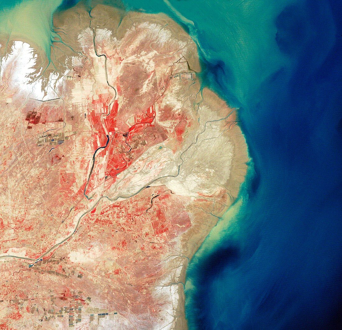
| Yellow River valley. Satellite image showing the extent of urban development surrounding China's Yellow River,also known as Huang He (dark line running from bottom left to upper right). North is at top. Red indicates vegetation,blue indicates water and beige indicates bare ground. Huange He stretches almost 5,5000 kilometres from eastern Tibet to the Bo Hai sea. Image data obtained in May 1979 using the Multispectral Scanner on NASA's Landsat 3 satellite. To view how this region looked in 2000,see image C003/6349 | |
| Licence : | Droits gérés |
| Crédit: | Science Photo Library / NASA |
| Taille de l’image : | 4266 px × 4121 px |
| Model Release : | Non requis |
| Property Release : | Non requis |
| Restrictions : | - |
Prix pour cette image À partir de 45 €
Produit vendu
(Calendrier, Carte postale, Carte de vœux, Impression sur textile, Packaging etc)
À partir de 45 €
Usage commercial
(Affichage, Annonce presse, Annonce TV, Carte, Digital - hors rés. sociaux, Digital - rés. sociaux etc)
À partir de 45 €
Éditorial
(Digital, Journal, Livre, Livre pratique, Magazine, Télévision etc)
À partir de 60 €
Usage non-commercial
(Digital - hors rés. sociaux, Digital - rés. sociaux etc)
À partir de 120 €
Mots clés
- 1900,
- 20ème siècle,
- agricole,
- agriculture,
- asiatique,
- Asie,
- Asie de l'Est,
- champ,
- champs,
- Chine,
- chinois,
- continent,
- côte,
- côtier,
- de l'espace,
- delta,
- eau,
- écoulement,
- estuaire,
- géographie,
- géographique,
- image satellite,
- littoral,
- observation de la terre,
- océan,
- rivière,
- rivières,
- satellite,
- Sciences de la Terre,
- sédiment,
- terres arables,
- terres cultivables,
- urbain,
- urbanisation,
- végétation,
- ville,
- XXème siècle