Chesapeake Bay crater,satellite image
Numéro d’image : 11564851
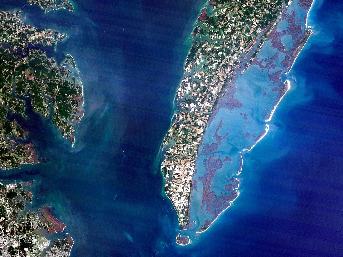
| Chesapeake Bay crater,satellite image. Satellite image of Chesapeake Bay,Virginia,USA. This is the location of the underwater Chesapeake Bay impact crater,which is thought to have been formed by a bolide that impacted the eastern shore of North America about 35 million years ago,during the late Eocene epoch. It is one of the best-preserved 'wet-target' or marine impact craters,and the largest impact crater in the USA | |
| Licence : | Droits gérés |
| Crédit: | Science Photo Library / Planetobserver |
| Taille de l’image : | 4843 px × 3632 px |
| Model Release : | Non requis |
| Property Release : | Non requis |
| Restrictions : | - |
Prix pour cette image À partir de 45 €
Produit vendu
(Calendrier, Carte postale, Carte de vœux, Impression sur textile, Packaging etc)
À partir de 45 €
Usage commercial
(Affichage, Annonce presse, Annonce TV, Carte, Digital - hors rés. sociaux, Digital - rés. sociaux etc)
À partir de 45 €
Éditorial
(Digital, Journal, Livre, Livre pratique, Magazine, Télévision etc)
À partir de 60 €
Usage non-commercial
(Digital - hors rés. sociaux, Digital - rés. sociaux etc)
À partir de 120 €
Mots clés
- américain,
- Amérique du Nord,
- bolide,
- collision,
- cratère,
- de l'espace,
- environnement,
- époque éocène,
- Etats-Unis,
- géographie,
- géographique,
- géologie,
- géologique,
- histoire,
- historique,
- image satellite,
- impact,
- le plus grand,
- météorite,
- N/A,
- observation de la terre,
- période éocène,
- préhistoire,
- préhistorique,
- satellite,
- sous l'eau,
- sous marin,
- sous-marin,
- structure d'impact,
- US,
- USA,
- Virginie