Comoro Islands,satellite image
Numéro d’image : 11564122
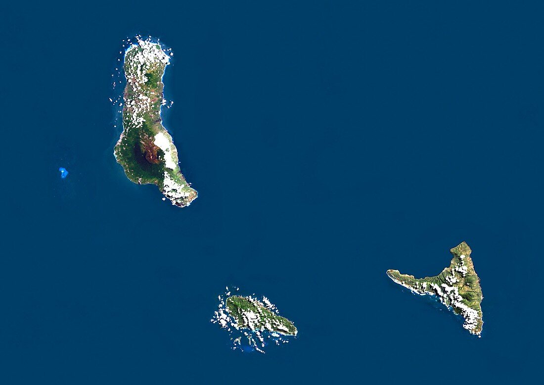
| Comoro Islands,satellite image. North is at top. Water is blue,vegetation is green,and clouds are white. The Comoro Islands is an archipelago of four volcanic islands,and is located in the Indian Ocean at the north end of the Mozambique Channel,off the coast of south-eastern Africa. The area shown here is around 100 kilometres across. The largest island,Grande Comore,is at upper left. Moheli is at lower centre,and Anjouan is at lower right. The fourth island,Mayotte (not seen),is to the south-east. Image data obtained by the Landsat 5 and Landsat 7 satellites | |
| Licence : | Droits gérés |
| Crédit: | Science Photo Library / Planetobserver |
| Taille de l’image : | 4978 px × 3520 px |
| Model Release : | Non requis |
| Property Release : | Non requis |
| Restrictions : | - |
Prix pour cette image À partir de 45 €
Produit vendu
(Calendrier, Carte postale, Carte de vœux, Impression sur textile, Packaging etc)
À partir de 45 €
Usage commercial
(Affichage, Annonce presse, Annonce TV, Carte, Digital - hors rés. sociaux, Digital - rés. sociaux etc)
À partir de 45 €
Éditorial
(Digital, Journal, Livre, Livre pratique, Magazine, Télévision etc)
À partir de 60 €
Usage non-commercial
(Digital - hors rés. sociaux, Digital - rés. sociaux etc)
À partir de 120 €
Mots clés
- africain,
- Afrique,
- archipel,
- canal du Mozambique,
- cartographie,
- contour masqué,
- côte,
- côtier,
- de l'espace,
- eau,
- environnement,
- état,
- frontière,
- frontières,
- géographie,
- géographique,
- île,
- îles,
- image satellite,
- Landsat,
- Landsat 5,
- landsat 7,
- littoral,
- Mayotte,
- mer,
- nation,
- observation de la terre,
- océan,
- Océan Indien,
- pays,
- satellite,
- Sciences de la Terre,
- terre,
- topographie