Bahrain,satellite image
Numéro d’image : 11564039
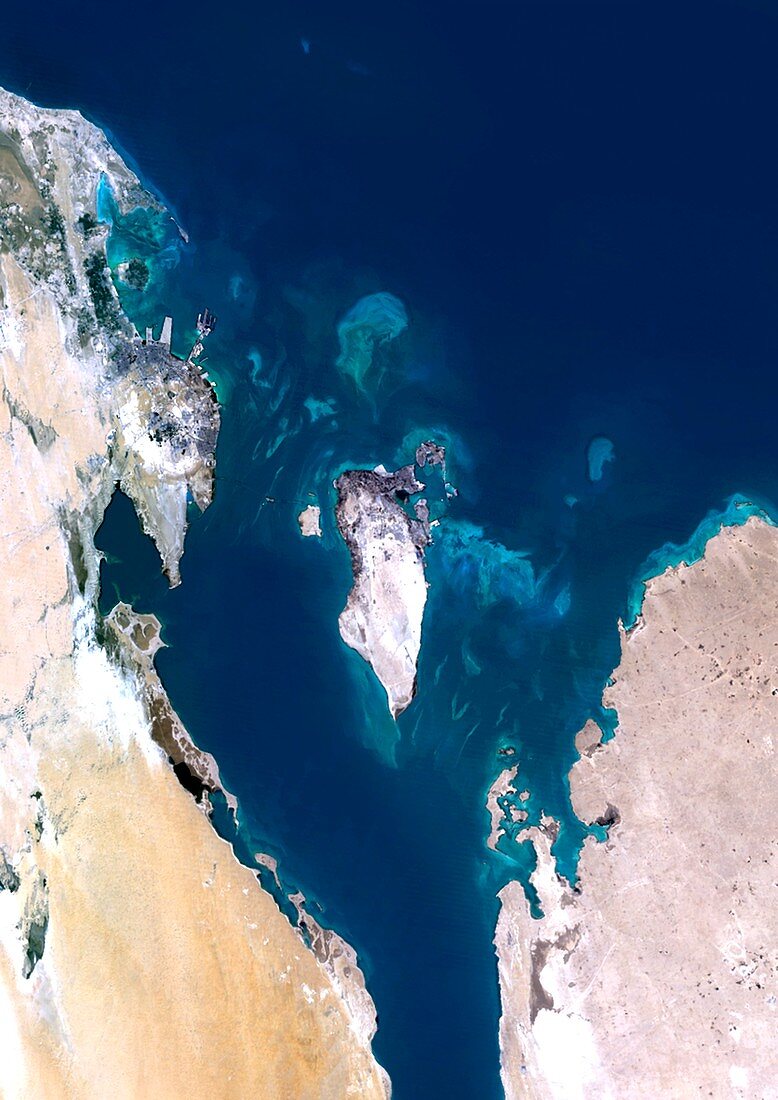
| Bahrain,satellite image. North is at top. Water is blue,deserts are brown and white,developed areas are grey,and clouds are white. Deep ocean is blue,with shallow areas and sand banks appearing as light blue. The island of Bahrain is at centre in the Persian Gulf. The coast of Saudi Arabia at left,and part of Quatar is at lower right. Bahrain is 48 kilometres long and 16 kilometres wide. Image data obtained by the Landsat 5 and Landsat 7 satellites | |
| Licence : | Droits gérés |
| Crédit: | Science Photo Library / Planetobserver |
| Taille de l’image : | 3520 px × 4978 px |
| Model Release : | Non requis |
| Property Release : | Non requis |
| Restrictions : | - |
Prix pour cette image À partir de 45 €
Produit vendu
(Calendrier, Carte postale, Carte de vœux, Impression sur textile, Packaging etc)
À partir de 45 €
Usage commercial
(Affichage, Annonce presse, Annonce TV, Carte, Digital - hors rés. sociaux, Digital - rés. sociaux etc)
À partir de 45 €
Éditorial
(Digital, Journal, Livre, Livre pratique, Magazine, Télévision etc)
À partir de 60 €
Usage non-commercial
(Digital - hors rés. sociaux, Digital - rés. sociaux etc)
À partir de 120 €
Mots clés
- asiatique,
- Asie,
- bancs de sable,
- cartographie,
- contour masqué,
- côte,
- côtier,
- de l'espace,
- eau,
- environnement,
- état,
- frontière,
- frontières,
- géographie,
- géographique,
- Golfe Persique,
- île,
- îles,
- image satellite,
- Landsat,
- Landsat 5,
- landsat 7,
- littoral,
- mer,
- Moyen Orient,
- Moyen-Orient,
- nation,
- observation de la terre,
- océan,
- pays,
- péninsule arabe,
- péninsule arabique,
- satellite,
- Sciences de la Terre,
- terre,
- topographie