North America,satellite image
Numéro d’image : 11563501
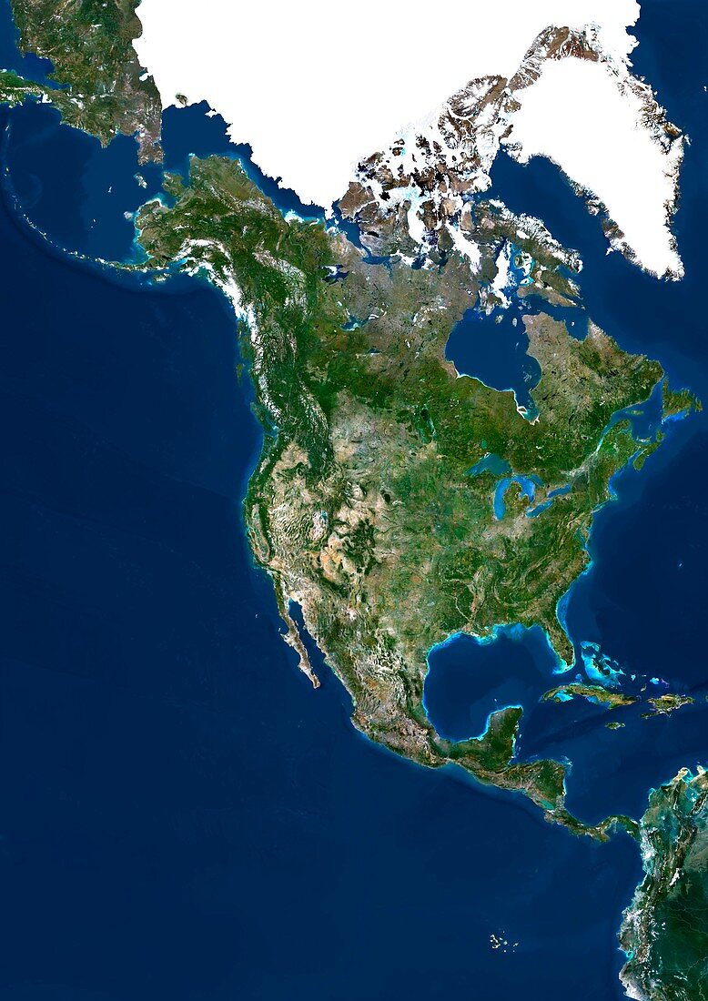
| North America,satellite image. The land is mostly covered by vegetation and seen as the green areas. Deserts,such as those in the Southwest USA (lower left) are shown in yellow,and mountain ranges are grey. Arctic regions,such as in northern Canada (top) are white. Oceans range from light blue (shallow coastal water) to dark blue (deep water). Image obtained using data from Landsat 5 and Landsat 7 satellites | |
| Licence : | Droits gérés |
| Crédit: | Science Photo Library / Planetobserver |
| Taille de l’image : | 3543 px × 5011 px |
| Model Release : | Non requis |
| Property Release : | Non requis |
| Restrictions : | - |
Prix pour cette image À partir de 45 €
Produit vendu
(Calendrier, Carte postale, Carte de vœux, Impression sur textile, Packaging etc)
À partir de 45 €
Usage commercial
(Affichage, Annonce presse, Annonce TV, Carte, Digital - hors rés. sociaux, Digital - rés. sociaux etc)
À partir de 45 €
Éditorial
(Digital, Journal, Livre, Livre pratique, Magazine, Télévision etc)
À partir de 60 €
Usage non-commercial
(Digital - hors rés. sociaux, Digital - rés. sociaux etc)
À partir de 120 €
Mots clés
- Amérique du Nord,
- Arctique,
- Atlantique,
- calotte glaciaire,
- Canada,
- canadien,
- carte,
- cartographie,
- continent,
- continents,
- de l'espace,
- Etats-Unis,
- européen,
- géographie,
- géographique,
- image satellite,
- Landsat 5,
- landsat 7,
- masse continentale,
- mer,
- mexicain,
- Mexique,
- nord américain,
- nord-américain,
- observation de la terre,
- océan,
- pacifique,
- satellite,
- science de la terre,
- terre,
- USA