Cape Town,South Africa,satellite image
Numéro d’image : 11555128
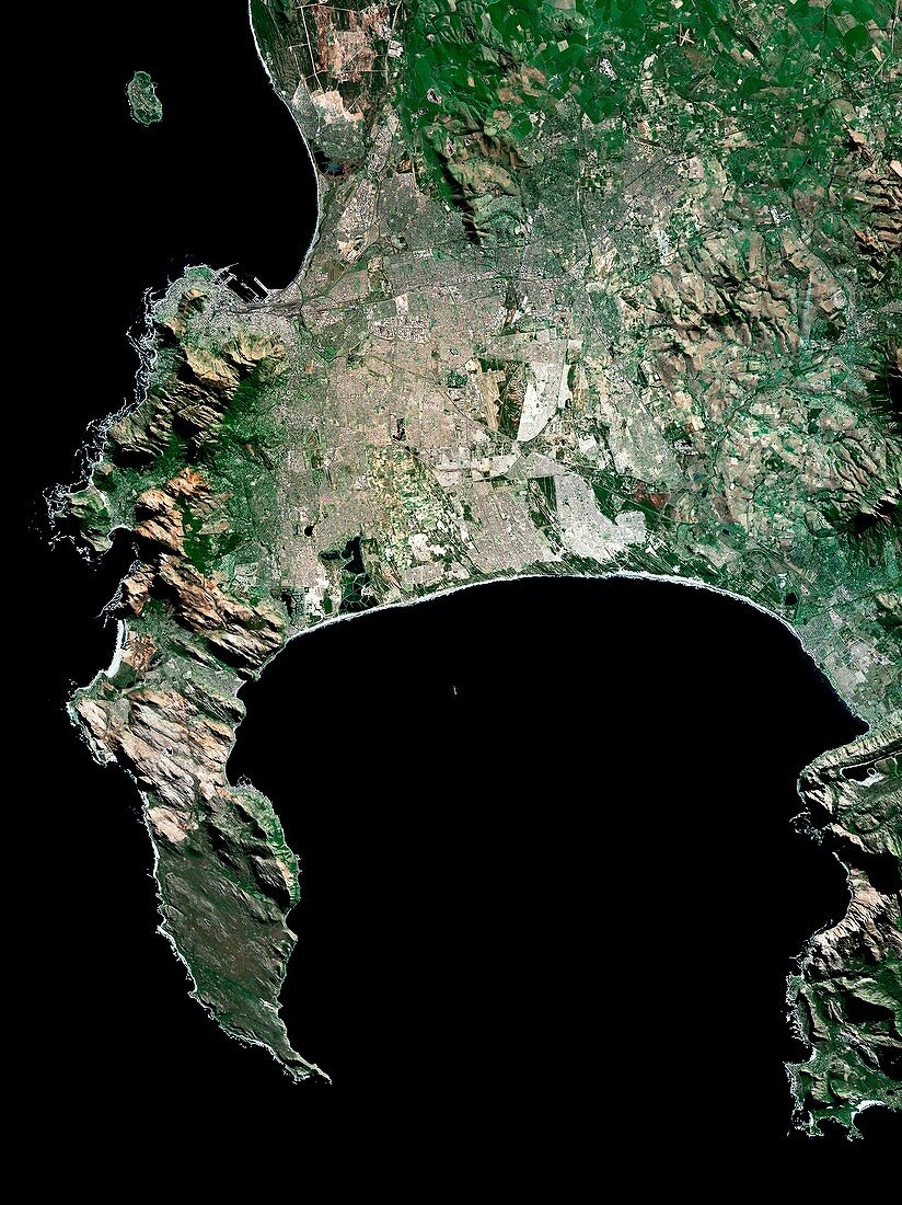
| Cape Town,South Africa. Satellite image of the city of Cape Town (upper centre and left) and its surrounding area in western South Africa. North is at top. Robben Island is at top left. Forested areas are dark green,agricultural fields are lighter shades of green and brown,urban areas are grey,and water is black. Image created using NaturalVue data obtained from the Landsat 7 satellite | |
| Licence : | Droits gérés |
| Crédit: | Science Photo Library / MDA Information Systems |
| Taille de l’image : | 3626 px × 4843 px |
| Model Release : | Non requis |
| Property Release : | Non requis |
| Restrictions : | - |
Prix pour cette image À partir de 45 €
Produit vendu
(Calendrier, Carte postale, Carte de vœux, Impression sur textile, Packaging etc)
À partir de 45 €
Usage commercial
(Affichage, Annonce presse, Annonce TV, Carte, Digital - hors rés. sociaux, Digital - rés. sociaux etc)
À partir de 45 €
Éditorial
(Digital, Journal, Livre, Livre pratique, Magazine, Télévision etc)
À partir de 60 €
Usage non-commercial
(Digital - hors rés. sociaux, Digital - rés. sociaux etc)
À partir de 120 €
Mots clés
- africain,
- Afrique,
- Afrique du Sud,
- Baie Table,
- bois,
- Cap de Bonne Espérance,
- Cape Town,
- champ,
- champs,
- côte atlantique,
- couleur naturelle,
- de l'espace,
- eau,
- forêt,
- forêts,
- géographie,
- géographique,
- image satellite,
- landsat 7,
- littoral,
- NASA,
- observation de la terre,
- Océan Atlantique,
- région boisée,
- satellite,
- terres arables,
- terres cultivables,
- urbain,
- urbanisation,
- végétation,
- ville