Le Havre,satellite image
Numéro d’image : 11553122
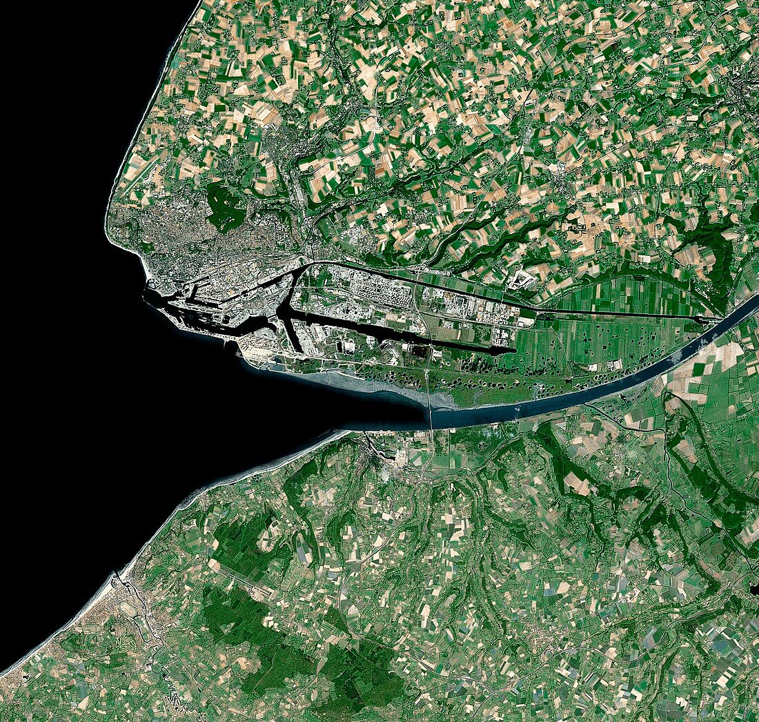
| Le Havre. Satellite image of the city of Le Havre (upper left) and its surrounding area on the northwestern coast of France. North is at top. Forested areas are dark green,agricultural fields are lighter shades of green and brown,urban areas are grey and water is black. The mouth of the river Seine is seen at centre and the city's ferry ports are the water channels at left. Image created using NaturalVue data obtained from the Landsat 7 satellite | |
| Licence : | Droits gérés |
| Crédit: | Science Photo Library / MDA Information Systems |
| Taille de l’image : | 4298 px × 4087 px |
| Model Release : | Non requis |
| Property Release : | Non requis |
| Restrictions : | - |
Prix pour cette image À partir de 45 €
Produit vendu
(Calendrier, Carte postale, Carte de vœux, Impression sur textile, Packaging etc)
À partir de 45 €
Usage commercial
(Affichage, Annonce presse, Annonce TV, Carte, Digital - hors rés. sociaux, Digital - rés. sociaux etc)
À partir de 45 €
Éditorial
(Digital, Journal, Livre, Livre pratique, Magazine, Télévision etc)
À partir de 60 €
Usage non-commercial
(Digital - hors rés. sociaux, Digital - rés. sociaux etc)
À partir de 120 €
Mots clés
- 2000,
- 21ème siècle,
- bois,
- canal,
- canaux,
- champ,
- champs,
- côtier,
- couleur naturelle,
- de l'espace,
- eau,
- Europe,
- européen,
- forêt,
- forêts,
- français,
- France,
- géographie,
- géographique,
- image satellite,
- landsat 7,
- Le Havre,
- marine,
- maritime,
- mer,
- observation de la terre,
- océan,
- port,
- région boisée,
- rivière,
- Royaume Uni,
- Royaume-Uni,
- satellite,
- Seine,
- terres arables,
- terres cultivables,
- urbain,
- urbanisation,
- végétation,
- ville,
- XX1ème siècle