Conical projection
Numéro d’image : 13495484
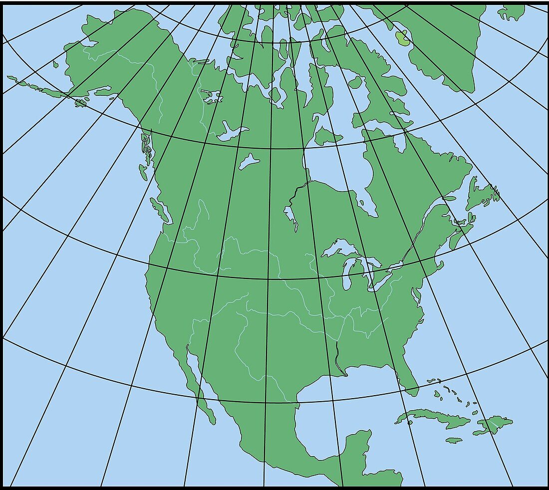
| A conical projection is obtained by projecting the surface of Earth onto a cone that is in contact with a parallel. On the resulting fan-shaped map, distortions become greater on either side of the contact zone. This projection system, which can portray only part of the planet, is frequently used to produce maps of regions in the middle latitudes. | |
| Licence : | Droits gérés |
| Crédit: | Science Photo Library / Science Source / QA International |
| Taille de l’image : | 3129 px × 2793 px |
| Model Release : | Non requis |
| Property Release : | Non requis |
| Restrictions : | - |
Prix pour cette image À partir de 45 €
Produit vendu
(Calendrier, Carte postale, Carte de vœux, Impression sur textile, Packaging etc)
À partir de 45 €
Usage commercial
(Affichage, Annonce presse, Annonce TV, Carte, Digital - hors rés. sociaux, Digital - rés. sociaux etc)
À partir de 45 €
Éditorial
(Digital, Journal, Livre, Livre pratique, Magazine, Télévision etc)
À partir de 60 €
Usage non-commercial
(Digital - hors rés. sociaux, Digital - rés. sociaux etc)
À partir de 120 €