Map of Breda,17th century
Numéro d’image : 12960002
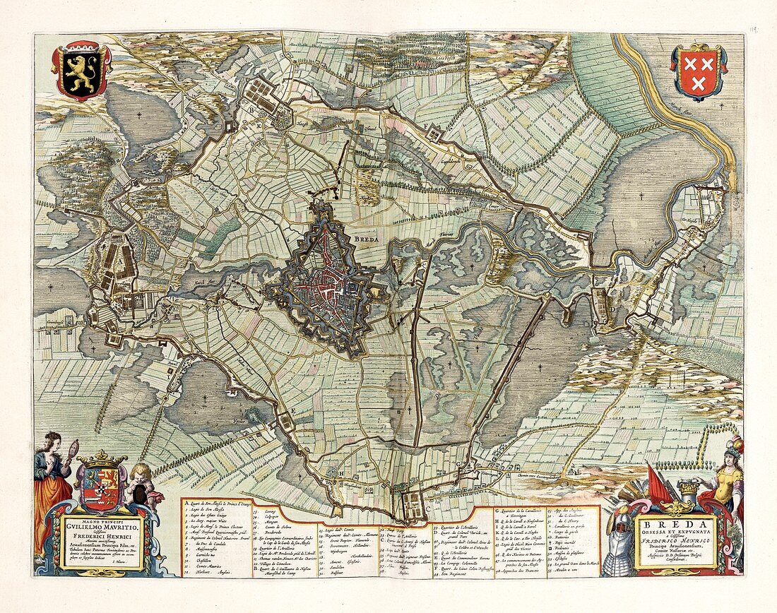
| Map of Breda,17th century. This fortified city,located in the province of North Brabant in the Dutch Republic,lies at the confluence of the Mark and Aa rivers. This city was of strategic importance in the 17th century. The coat-of-arms is at top right. This map is from 'Toonneel der steden van de Vereenighde Nederlanden' (1652),an atlas of maps of the cities and towns of the United Provinces of the Netherlands,published by Dutch cartographer Joan Blau (1596-1673). | |
| Licence : | Droits gérés |
| Crédit: | Science Photo Library / Library of Congress,Geography and Map Division |
| Taille de l’image : | 6167 px × 4866 px |
| Model Release : | Non requis |
| Property Release : | Non requis |
| Restrictions : | - |
Prix pour cette image À partir de 45 €
Produit vendu
(Calendrier, Carte postale, Carte de vœux, Impression sur textile, Packaging etc)
À partir de 45 €
Usage commercial
(Affichage, Annonce presse, Annonce TV, Carte, Digital - hors rés. sociaux, Digital - rés. sociaux etc)
À partir de 45 €
Éditorial
(Digital, Journal, Livre, Livre pratique, Magazine, Télévision etc)
À partir de 60 €
Usage non-commercial
(Digital - hors rés. sociaux, Digital - rés. sociaux etc)
À partir de 120 €