Radar image of Mars, 1988
Numéro d’image : 12919041
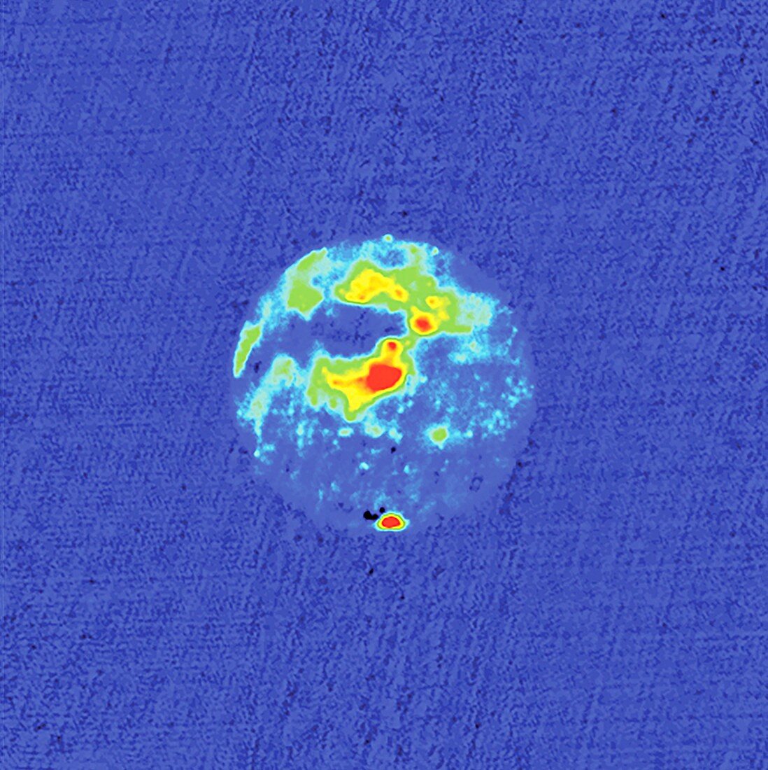
| Radar image of Mars. This image dates from 1988 and was made with the Goldstone Solar System Radar (GSSR) system. Red areas are areas of high radar reflectivity. The south polar ice cap, at the bottom of the image, is the area of highest reflectivity. The other areas of high reflectivity are associated with the giant shield volcanoes of the Tharsis ridge. The dark area to the West of the Tharsis ridge showed no detectable radar echoes. The investigators call this region the 'Stealth' region and believe it is a huge deposit of low density, volcanic ash with an absence of volume scatterers (rocks) to depths of many meters. The radar pulses were transmitted from Earth using the Goldstone Deep Space Communications Complex (GDSCC), with reflected data received by the Very Large Array (VLA). | |
| Licence : | Droits gérés |
| Crédit: | Science Photo Library / NSF / AUI / D. Muhleman, B. Butler, A. Grossman, and M. Slade, NRAO |
| Taille de l’image : | 2959 px × 2965 px |
| Model Release : | Non requis |
| Property Release : | Non requis |
| Restrictions : |
|
Prix pour cette image À partir de 45 €
Produit vendu
(Calendrier, Carte postale, Carte de vœux, Impression sur textile, Packaging etc)
À partir de 45 €
Usage commercial
(Affichage, Annonce presse, Annonce TV, Carte, Digital - hors rés. sociaux, Digital - rés. sociaux etc)
À partir de 45 €
Éditorial
(Digital, Journal, Livre, Livre pratique, Magazine, Télévision etc)
À partir de 60 €
Usage non-commercial
(Digital - hors rés. sociaux, Digital - rés. sociaux etc)
À partir de 120 €