Miller Atlas, c1519
Numéro d’image : 12916182
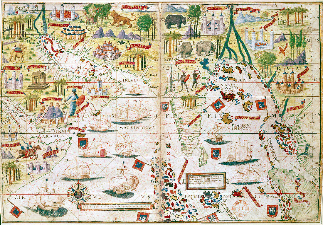
| Miller Atlas, c1519. The Portuguese Miller Atlas was discovered in France in 19th century, although its origins are uncertain. It shows the Indian Ocean, the Persian Gulf, India and North Africa, and was produced immediately after early Portuguese expeditions by da Gama, Cabral, Coehlo and Albuquerque (1489-1515). | |
| Licence : | Droits gérés |
| Crédit: | Science Photo Library / Heritage Images / Ann Ronan Picture Library |
| Taille de l’image : | 5009 px × 3496 px |
| Model Release : | Non requis |
| Property Release : | Non requis |
| Restrictions : | - |
Prix pour cette image À partir de 45 €
Produit vendu
(Calendrier, Carte postale, Carte de vœux, Impression sur textile, Packaging etc)
À partir de 45 €
Usage commercial
(Affichage, Annonce presse, Annonce TV, Carte, Digital - hors rés. sociaux, Digital - rés. sociaux etc)
À partir de 45 €
Éditorial
(Digital, Journal, Livre, Livre pratique, Magazine, Télévision etc)
À partir de 60 €
Usage non-commercial
(Digital - hors rés. sociaux, Digital - rés. sociaux etc)
À partir de 120 €
Mots clés
- 1500,
- 16ème siècle,
- Albuquerque,
- animal,
- animaux,
- arbre,
- atlas,
- camelus,
- caractéristique géographique,
- carte,
- chameau,
- chameaux,
- concept,
- continent,
- découverte,
- exotique,
- exploration,
- faune,
- géographie,
- géographique,
- histoire,
- historique,
- illustration,
- jungle,
- mer,
- monde,
- nature,
- navigation,
- oeuvre,
- palmier,
- pays,
- plante,
- portugais,
- Portugal,
- seizième siècle,
- siècle,
- Vasco da Gama,
- velum,
- voile,
- XVIème siècle