Map of London, 1560
Numéro d’image : 12902142
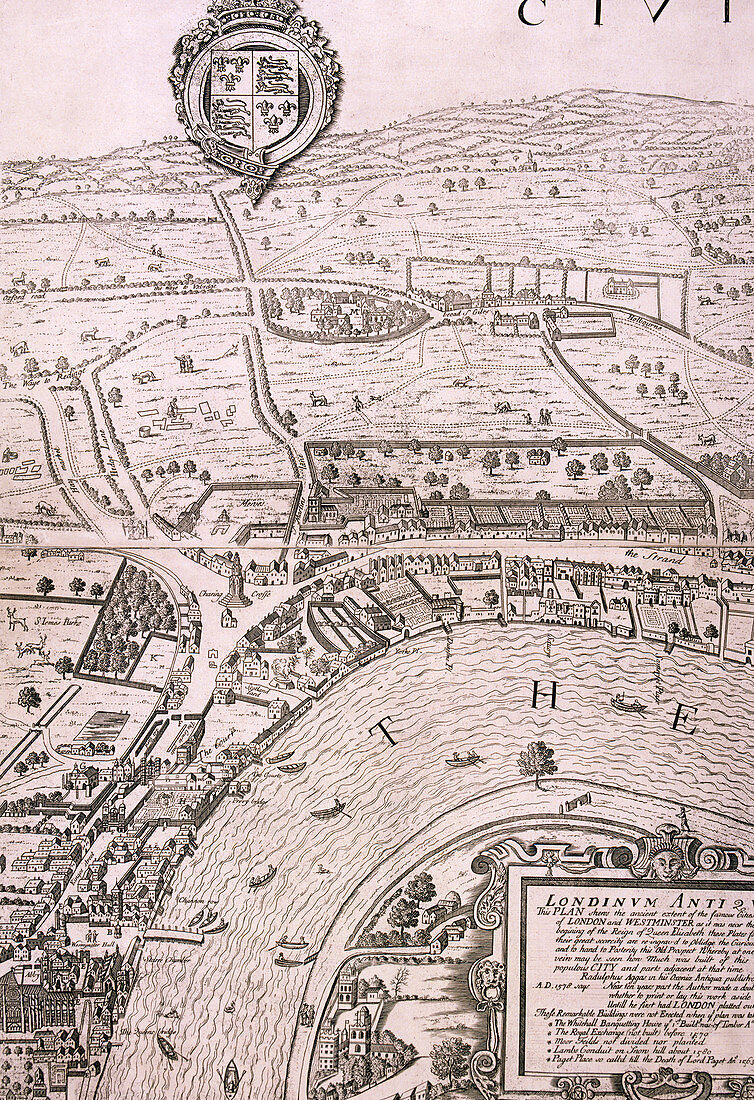
| Map of London in the year 1560; showing the area between Westminster and the Strand, with Lambeth to the south of the River Thames and the Tudor royal arms at the top. Artist: George Vertue. | |
| Licence : | Droits gérés |
| Crédit: | Science Photo Library / Heritage Images / London Metropolitan Archives-City of London |
| Taille de l’image : | 3461 px × 5047 px |
| Model Release : | Non requis |
| Property Release : | Non requis |
| Restrictions : | - |
Prix pour cette image À partir de 45 €
Produit vendu
(Calendrier, Carte postale, Carte de vœux, Impression sur textile, Packaging etc)
À partir de 45 €
Usage commercial
(Affichage, Annonce presse, Annonce TV, Carte, Digital - hors rés. sociaux, Digital - rés. sociaux etc)
À partir de 45 €
Éditorial
(Digital, Journal, Livre, Livre pratique, Magazine, Télévision etc)
À partir de 60 €
Usage non-commercial
(Digital - hors rés. sociaux, Digital - rés. sociaux etc)
À partir de 120 €
Mots clés
- 1500,
- 16ème siècle,
- anglais,
- Angleterre,
- armes,
- armoiries,
- blason,
- caractéristique géographique,
- carte,
- Cité de Wesminster,
- gens,
- géographie,
- géographique,
- George,
- GEORGE VERTUE,
- graver,
- gravure,
- héraldique,
- histoire,
- historique,
- illustration,
- la Tamise,
- Lambeth,
- londres,
- monochrome,
- n/b,
- noir et blanc,
- oeuvre,
- personne,
- redevance,
- rivière,
- royal,
- royauté,
- seizième siècle,
- siècle,
- Tamise,
- Tudor,
- ville de Londres,
- Westminster,
- XVIème siècle