Map of London, 1727
Numéro d’image : 12902139
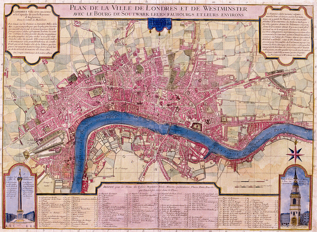
| Map of London, 1727. French map of the City of London, City of Westminster, River Thames, Lambeth, Southwark and surrounding areas. Bottom left inset shows the Monument, bottom right inset shows St Mary-le-Bow, with a key in the centre. | |
| Licence : | Droits gérés |
| Crédit: | Science Photo Library / Heritage Images / London Metropolitan Archives-City of London |
| Taille de l’image : | 4843 px × 3541 px |
| Model Release : | Non requis |
| Property Release : | Non requis |
| Restrictions : | - |
Prix pour cette image À partir de 45 €
Produit vendu
(Calendrier, Carte postale, Carte de vœux, Impression sur textile, Packaging etc)
À partir de 45 €
Usage commercial
(Affichage, Annonce presse, Annonce TV, Carte, Digital - hors rés. sociaux, Digital - rés. sociaux etc)
À partir de 45 €
Éditorial
(Digital, Journal, Livre, Livre pratique, Magazine, Télévision etc)
À partir de 60 €
Usage non-commercial
(Digital - hors rés. sociaux, Digital - rés. sociaux etc)
À partir de 120 €
Mots clés
- 1700,
- 18ème siècle,
- anglais,
- Angleterre,
- architecture,
- bleu,
- caractéristique géographique,
- carte,
- champ,
- christianisme,
- église,
- français,
- France,
- géographie,
- géographique,
- graver,
- gravure,
- histoire,
- historique,
- illustration,
- la Tamise,
- londres,
- monument,
- oeuvre,
- pays,
- religieux,
- religion,
- rivière,
- rose,
- siècle,
- Tamise,
- XVIIIème siècle