Electrical resistive tomography report
Numéro d’image : 12656461
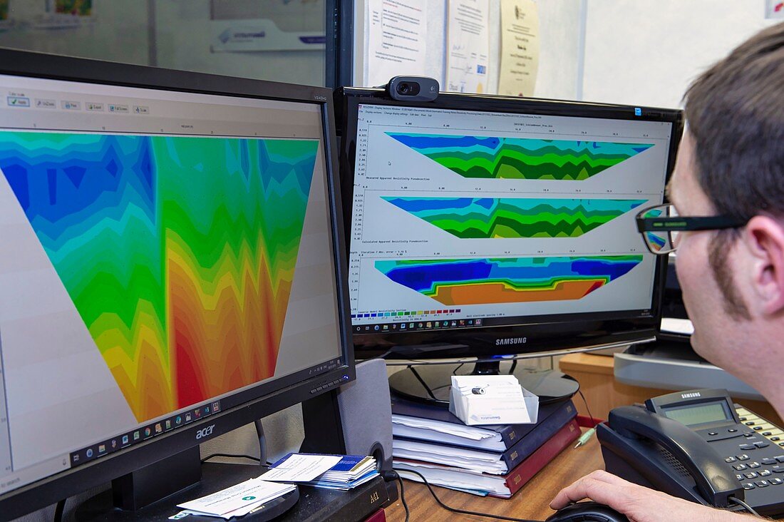
| Screen readout from an Electrical Resistive Tomography (ERT) survey of a 4 metre depth slice below the soil surface. Blue shows areas of high moisture and low resistivity at the subsoil boundary. Red represents the underlying geology. | |
| Licence : | Droits gérés |
| Crédit: | Science Photo Library / Murray, Louise |
| Taille de l’image : | 4856 px × 3232 px |
| Model Release : | Le droit n'est pas encore disponible. Merci de nous contacter avant utilisation. |
| Property Release : | Non requis |
| Restrictions : |
|
Prix pour cette image À partir de 45 €
Produit vendu
(Calendrier, Carte postale, Carte de vœux, Impression sur textile, Packaging etc)
À partir de 45 €
Usage commercial
(Affichage, Annonce presse, Annonce TV, Carte, Digital - hors rés. sociaux, Digital - rés. sociaux etc)
À partir de 45 €
Éditorial
(Digital, Journal, Livre, Livre pratique, Magazine, Télévision etc)
À partir de 60 €
Usage non-commercial
(Digital - hors rés. sociaux, Digital - rés. sociaux etc)
À partir de 120 €