Desceliers' Map of Australia
Numéro d’image : 12655716
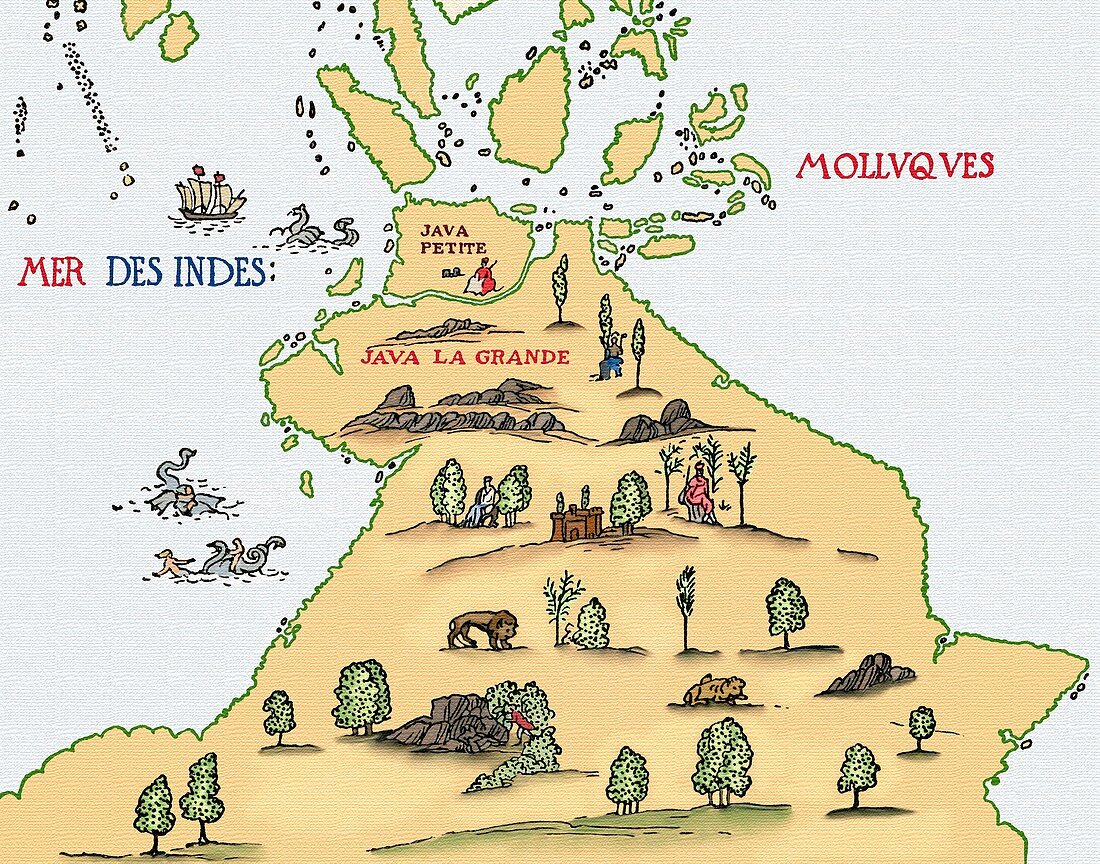
| Detail from the 1546 world map created by the French cartographer, Pierre Desceliers an eminent member of the Dieppe school of Cartography. It was based on numerous sources including travellers and mariners. The names Java la Grande and Java Petite, derived from Marco Polo, produced confusion in the 16th century. Gerardus Mercator and Portuguese cartographers applied the term Java Major to the island of Java whereas the Dieppe cartographers thought it was a vast landmass south of Java itself. According to Marco Polo, Java la Grande was the largest island in the world; his Java Petite was Sumatra. On his map, Desceliers inscribed this southern land mass (approximately in the position of Australia) as â€Terra Australis, recently discovered but not fully knownâ€. The islands of the Molluques, (Moluccas) known as the Spice Islands, were a source of Portuguese-Dutch conflict. | |
| Licence : | Droits gérés |
| Crédit: | Science Photo Library / Terry, Sheila |
| Taille de l’image : | 4717 px × 3705 px |
| Model Release : | Non requis |
| Property Release : | Non requis |
| Restrictions : | - |
Prix pour cette image À partir de 45 €
Produit vendu
(Calendrier, Carte postale, Carte de vœux, Impression sur textile, Packaging etc)
À partir de 45 €
Usage commercial
(Affichage, Annonce presse, Annonce TV, Carte, Digital - hors rés. sociaux, Digital - rés. sociaux etc)
À partir de 45 €
Éditorial
(Digital, Journal, Livre, Livre pratique, Magazine, Télévision etc)
À partir de 60 €
Usage non-commercial
(Digital - hors rés. sociaux, Digital - rés. sociaux etc)
À partir de 120 €