Ptolemy's Map of Ceylon, 2nd Century
Numéro d’image : 12653058
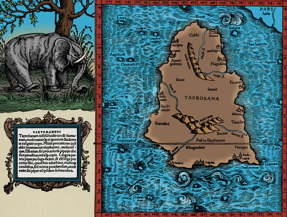
| Ptolemy's map of Ceylon based on the description contained in Ptolemy's book Geographia, written 150 AD. Although authentic maps have never been found, the Geographia contains thousands of references to various parts of the old world, with coordinates for most, which allowed cartographers to reconstruct Ptolemy's world view when the manuscript was re-discovered around 1300 AD. Perhaps the most significant contribution of Ptolemy and his maps is the first uses of longitudinal and latitudinal lines and the specifying of terrestrial locations by celestial observations. When his Geographia was translated from Greek into Arabic in the 9th century and subsequently into Latin in Western Europe at the beginning of the 15th century, the idea of a global coordinate system revolutionized medieval Islamic and European geographical thinking and put it upon a scientific and numerical basis. This image has been colorized. | |
| Licence : | Droits gérés |
| Crédit: | Science Photo Library / Science Source |
| Taille de l’image : | 3887 px × 2942 px |
| Model Release : | Non requis |
| Property Release : | Non requis |
| Restrictions : | - |
Prix pour cette image À partir de 45 €
Produit vendu
(Calendrier, Carte postale, Carte de vœux, Impression sur textile, Packaging etc)
À partir de 45 €
Usage commercial
(Affichage, Annonce presse, Annonce TV, Carte, Digital - hors rés. sociaux, Digital - rés. sociaux etc)
À partir de 45 €
Éditorial
(Digital, Journal, Livre, Livre pratique, Magazine, Télévision etc)
À partir de 60 €
Usage non-commercial
(Digital - hors rés. sociaux, Digital - rés. sociaux etc)
À partir de 120 €
Mots clés
- 15ème siècle,
- 2ème siècle,
- âges moyens,
- amélioration,
- amélioré,
- augmenté,
- bien connu,
- carte,
- cartographie,
- cartographique,
- célèbre,
- Ceylon,
- Claudius Ptolemaeus,
- Claudius Ptolemy,
- coloration,
- coloré,
- colorié,
- colorisation,
- colorisé,
- époque médiévale,
- GEOGRAPHIA,
- géographie,
- géographique,
- histoire,
- historique,
- important,
- influent,
- médiéval,
- médiévale,
- moyen âge,
- notable,
- remarquable,
- renforcé,
- réputé,
- Sri Lanka,
- topographie,
- XVème siècle