Joan Blaeu, Gulf of Saint Lawrence Map, 17th Century
Numéro d’image : 12651922
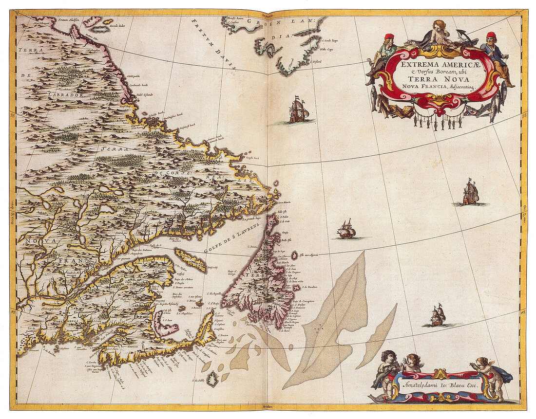
| The Gulf of Saint Lawrence is bounded on the north by the Labrador Peninsula and Quebec, to the east by Saint-Pierre and Newfoundland, to the south by the Nova Scotia peninsula and Cape Breton Island, and to the west by the Gaspe Peninsula, New Brunswick, and Quebec. As for significant islands the Gulf of Saint Lawrence contains Anticosti Island, PEI, iles-de-la-Madeleine, Cape Breton Island, Saint Pierre Island, and Miquelon-Langlade. Joan Blaeu (1596-1673) was a Dutch cartographer, the son of cartographer Willem Blaeu. In 1635 they published the Atlas Novus (full title: Theatrum orbis terrarum, sive, Atlas novus) in two volumes. The Atlas Maior is the final version of Joan Blaeu's atlas, published in Amsterdam between 1662 and 1672, in Latin, French, Dutch, German and Spanish, containing 594 maps and around 3, 000 pages of text. The Blaeu maps emphasized fine art and colours, being the most expensive of the time. | |
| Licence : | Droits gérés |
| Crédit: | Science Photo Library / Science Source |
| Taille de l’image : | 4200 px × 3289 px |
| Model Release : | Non requis |
| Property Release : | Non requis |
| Restrictions : | - |
Prix pour cette image À partir de 45 €
Produit vendu
(Calendrier, Carte postale, Carte de vœux, Impression sur textile, Packaging etc)
À partir de 45 €
Usage commercial
(Affichage, Annonce presse, Annonce TV, Carte, Digital - hors rés. sociaux, Digital - rés. sociaux etc)
À partir de 45 €
Éditorial
(Digital, Journal, Livre, Livre pratique, Magazine, Télévision etc)
À partir de 60 €
Usage non-commercial
(Digital - hors rés. sociaux, Digital - rés. sociaux etc)
À partir de 120 €