James Bruce, Sources of the Nile Map, 1790
Numéro d’image : 12650605
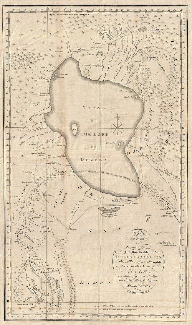
| Detailed 1790 map of Ethiopia (Abyssinia) and the source of the Blue Nile by James Bruce. Cantered on Lake Tana (Tzana), this map covers from the Ethiopian capital at Gondar south as far as the Saccala District and the Geesh Abay (Geesh Springs). The map plots Bruce's travels in search of the source of the Blue Nile starting from the Ethiopian capital of Gondar. Local guides led Bruce southwards around Lake Tana (Tzana) and eventually down the Abay River to Gish Abay, the source of the Blue Nile. Bruce claimed to have discovered the Gish Abay springs, but in a fact that he was well aware of, was merely retracing the steps of the Jesuit missionaries Pedro Paez and Jeronimo Lobo. | |
| Licence : | Droits gérés |
| Crédit: | Science Photo Library / Science Source |
| Taille de l’image : | 2846 px × 4800 px |
| Model Release : | Non requis |
| Property Release : | Non requis |
| Restrictions : | - |
Prix pour cette image À partir de 45 €
Produit vendu
(Calendrier, Carte postale, Carte de vœux, Impression sur textile, Packaging etc)
À partir de 45 €
Usage commercial
(Affichage, Annonce presse, Annonce TV, Carte, Digital - hors rés. sociaux, Digital - rés. sociaux etc)
À partir de 45 €
Éditorial
(Digital, Journal, Livre, Livre pratique, Magazine, Télévision etc)
À partir de 60 €
Usage non-commercial
(Digital - hors rés. sociaux, Digital - rés. sociaux etc)
À partir de 120 €