Guillaume Delisle, Mississippi River Map, 1702
Numéro d’image : 12648540
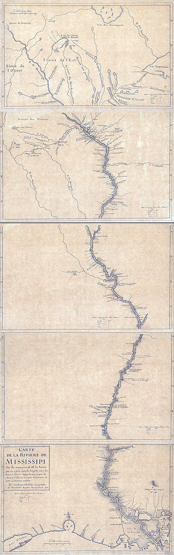
| Map of the Mississippi River: on the memoirs of Mr. Le Sueur who took all the tours and detours with the compass from the sea to the St. Pierre River, and took the pole height in several places, 1702. Pen-and-ink and watercolour. Also shows cities and towns in the Mississippi River. Guillaume Delisle (1675-1726) was a French cartographer known for his popular and accurate maps of Europe and the newly explored Americas. Delisle did not travel with the explorers. He drew maps mostly in his office, relying on a variety of data. The quality of his maps depended on a solid network to provide him first-hand information. Delisle had access to recent accounts of travellers who were returning from the New World, which gave him an advantage over his competitors. When he could not confirm the accuracy of a source, he would indicate it clearly on his maps. | |
| Licence : | Droits gérés |
| Crédit: | Science Photo Library / Science Source / Geography and Map Division / LOC |
| Taille de l’image : | 2072 px × 6600 px |
| Model Release : | Non requis |
| Property Release : | Non requis |
| Restrictions : | - |
Prix pour cette image À partir de 45 €
Produit vendu
(Calendrier, Carte postale, Carte de vœux, Impression sur textile, Packaging etc)
À partir de 45 €
Usage commercial
(Affichage, Annonce presse, Annonce TV, Carte, Digital - hors rés. sociaux, Digital - rés. sociaux etc)
À partir de 45 €
Éditorial
(Digital, Journal, Livre, Livre pratique, Magazine, Télévision etc)
À partir de 60 €
Usage non-commercial
(Digital - hors rés. sociaux, Digital - rés. sociaux etc)
À partir de 120 €
Mots clés
- 1700,
- 1702,
- 18ème siècle,
- américain,
- Amérique,
- Amérique du Nord,
- art,
- bien connu,
- carte,
- cartographie,
- cartographique,
- célèbre,
- fleuve Mississippi,
- français,
- géographie,
- géographique,
- GUILLAUME DELISLE,
- histoire,
- historique,
- illustration,
- important,
- influent,
- nord américain,
- nord-américain,
- notable,
- oeuvre,
- remarquable,
- réputé,
- XVIIIème siècle