Guillaume Delisle, North America Map, 1760s
Numéro d’image : 12648537
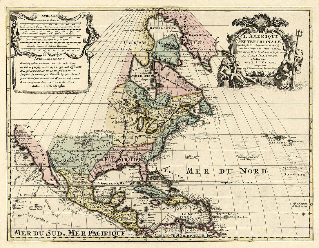
| North America. Based on observations of Mrs. of the Royal Academy of Sciences. & some others, & on the most recorded memories. Scale 1:19, 000, 000. Hand coloured. Shows some roads of exploration, land and sea. Guillaume Delisle (February 28, 1675, January 25, 1726) was a French cartographer known for his popular and accurate maps of Europe and the newly explored Americas. Like many cartographers of his day, Delisle did not travel with the explorers. He drew maps mostly in his office, relying on a variety of data. The quality of his maps depended on a solid network to provide him first-hand information. Delisle had access to recent accounts of travellers who were returning from the New World, which gave him an advantage over his competitors. He also kept current with recent discoveries, especially in astronomy and measurement. When he could not confirm the accuracy of a source, he would indicate it clearly on his maps. Published Amsterdam, At R. & J. Ottens 1760s. | |
| Licence : | Droits gérés |
| Crédit: | Science Photo Library / Science Source / Geography and Map Division / LOC |
| Taille de l’image : | 4275 px × 3328 px |
| Model Release : | Non requis |
| Property Release : | Non requis |
| Restrictions : | - |
Prix pour cette image À partir de 45 €
Produit vendu
(Calendrier, Carte postale, Carte de vœux, Impression sur textile, Packaging etc)
À partir de 45 €
Usage commercial
(Affichage, Annonce presse, Annonce TV, Carte, Digital - hors rés. sociaux, Digital - rés. sociaux etc)
À partir de 45 €
Éditorial
(Digital, Journal, Livre, Livre pratique, Magazine, Télévision etc)
À partir de 60 €
Usage non-commercial
(Digital - hors rés. sociaux, Digital - rés. sociaux etc)
À partir de 120 €
Mots clés
- 1700,
- 1760,
- 18ème siècle,
- Amérique Centrale,
- Amérique du Nord,
- art,
- bien connu,
- Canada,
- canadien,
- carte,
- cartographie,
- cartographique,
- célèbre,
- français,
- géographie,
- géographique,
- GUILLAUME DELISLE,
- histoire,
- historique,
- illustration,
- important,
- influent,
- nord américain,
- nord-américain,
- notable,
- oeuvre,
- remarquable,
- réputé,
- XVIIIème siècle