Herman Moll, North America, English Dominions, 1731
Numéro d’image : 12648533
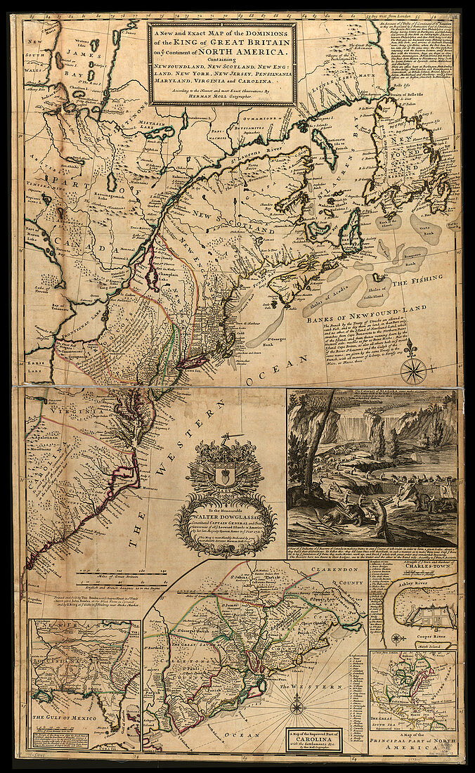
| A new and exact map of the dominions of the King of Great Britain on ye continent of North America, containing Newfoundland, New Scotland, New England, New York, New Jersey, Pensilvania, Maryland, Virginia and Carolina. Herman Moll (1654-1732), was a London cartographer, engraver, and publisher. During the 1690s he published his first major independent work, the Thesaurus Geographicus. In the years that followed he brought out several volumes including Fifty-six new and accurate maps of Great Britain, a book of maps of the British Isles. In 1711 he began his Atlas Geographus, which appeared in monthly deliveries from 1711 to 1717, and eventually comprised five volumes. This included a full geographical representation of the world in colour maps and illustrations. As with his earlier works, the Atlas Geographus was eagerly copied and imitated. | |
| Licence : | Droits gérés |
| Crédit: | Science Photo Library / Science Source / Geography and Map Division / LOC |
| Taille de l’image : | 2951 px × 4800 px |
| Model Release : | Non requis |
| Property Release : | Non requis |
| Restrictions : | - |
Prix pour cette image À partir de 45 €
Produit vendu
(Calendrier, Carte postale, Carte de vœux, Impression sur textile, Packaging etc)
À partir de 45 €
Usage commercial
(Affichage, Annonce presse, Annonce TV, Carte, Digital - hors rés. sociaux, Digital - rés. sociaux etc)
À partir de 45 €
Éditorial
(Digital, Journal, Livre, Livre pratique, Magazine, Télévision etc)
À partir de 60 €
Usage non-commercial
(Digital - hors rés. sociaux, Digital - rés. sociaux etc)
À partir de 120 €
Mots clés
- 1700,
- 1730,
- 1731,
- 18ème siècle,
- américain,
- Amérique,
- Amérique du Nord,
- anglais,
- art,
- bien connu,
- carte,
- cartographie,
- cartographique,
- célèbre,
- géographie,
- géographique,
- HERMAN MOLL,
- histoire,
- historique,
- illustration,
- important,
- influent,
- New Jersey,
- New York,
- nord américain,
- nord-américain,
- notable,
- Nouvelle Angleterre,
- NY,
- oeuvre,
- Pennsylvanie,
- remarquable,
- réputé,
- Terre Neuve,
- XVIIIème siècle