Martian highlands and lowlands, Mars Express image
Numéro d’image : 12539688
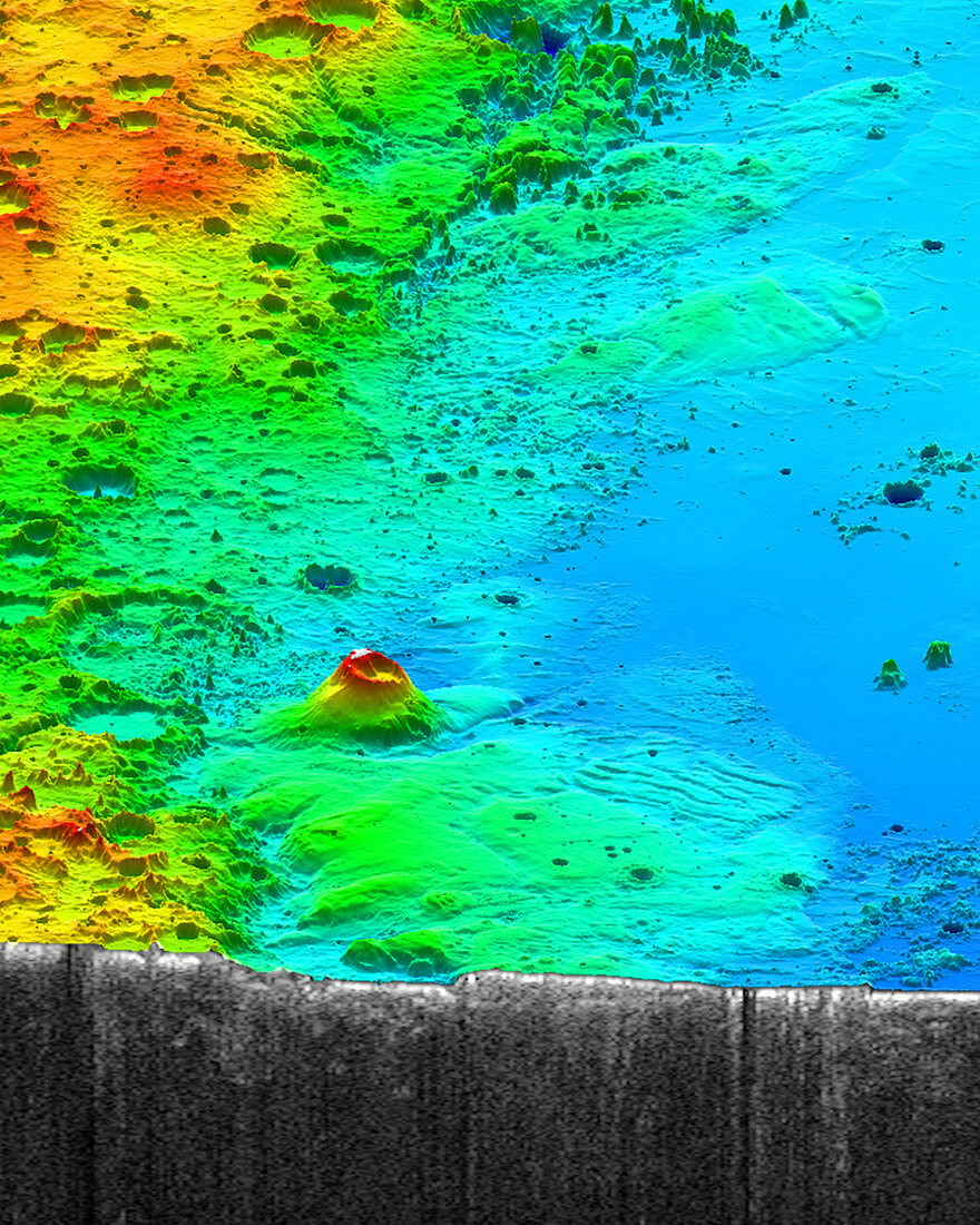
| Mars Express radar image of the topographic divide between the Martian highlands and lowlands. This area contains the Medusae Fossae Formation, a region of of soft, easily eroded deposit that extends for nearly 1000 kilometres along the Martian equator. Image obtained by the spacecraft's MARSIS (Mars Advanced Radar for Subsurface and Ionosphere Sounding) instrument. | |
| Licence : | Droits gérés |
| Crédit: | Science Photo Library / Smithsonian / JPL / Univ. of Rome / NASA / ASI / ESA |
| Taille de l’image : | 1200 px × 1500 px |
| Model Release : | Non requis |
| Property Release : | Non requis |
| Restrictions : |
|
Prix pour cette image À partir de 45 €
Produit vendu
(Calendrier, Carte postale, Carte de vœux, Impression sur textile, Packaging etc)
À partir de 45 €
Usage commercial
(Affichage, Annonce presse, Annonce TV, Carte, Digital - hors rés. sociaux, Digital - rés. sociaux etc)
À partir de 45 €
Éditorial
(Digital, Journal, Livre, Livre pratique, Magazine, Télévision etc)
À partir de 60 €
Usage non-commercial
(Digital - hors rés. sociaux, Digital - rés. sociaux etc)
À partir de 120 €