British Isles, 17th century
Numéro d’image : 12450107
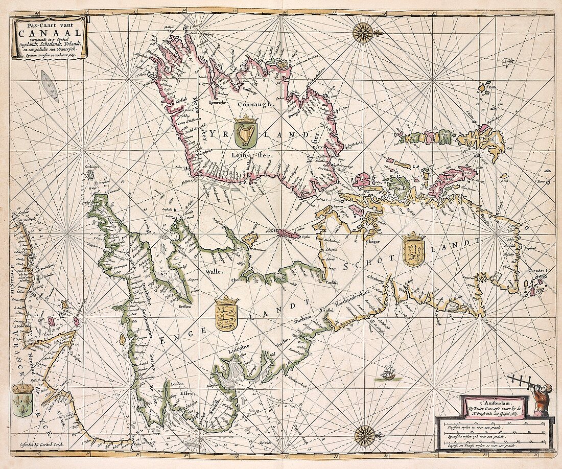
| British Isles. 17th-century map of the British Isles, showing the nations and coats-of-arms for England, Scotland, Ireland and part of the coast of northern France. North is at right. This is a sea-chart, and includes ships, compass roses and rhumb lines. Dated 1669 and titled 'Pas-Caart vant Canaal', this map is by the Dutch cartographer Pieter Goos (1616-1675). It was published in Amsterdam in 1672. The scale at bottom right is in Dutch, Spanish and English and French miles. | |
| Licence : | Droits gérés |
| Crédit: | Science Photo Library / NEW YORK PUBLIC LIBRARY / Lionel Pincus and Princess Firyal Map Division |
| Taille de l’image : | 5264 px × 4394 px |
| Model Release : | Non requis |
| Property Release : | Non requis |
| Restrictions : | - |
Prix pour cette image À partir de 45 €
Produit vendu
(Calendrier, Carte postale, Carte de vœux, Impression sur textile, Packaging etc)
À partir de 45 €
Usage commercial
(Affichage, Annonce presse, Annonce TV, Carte, Digital - hors rés. sociaux, Digital - rés. sociaux etc)
À partir de 45 €
Éditorial
(Digital, Journal, Livre, Livre pratique, Magazine, Télévision etc)
À partir de 60 €
Usage non-commercial
(Digital - hors rés. sociaux, Digital - rés. sociaux etc)
À partir de 120 €
Mots clés
- 1600,
- 1672,
- 17ème siècle,
- anglais,
- Angleterre,
- Atlantique,
- aucun,
- bâteaux,
- blason,
- carte,
- cartographie,
- cartographique,
- DE KUSTEN VAN ENGELANDT,
- DE KUSTEN VAN'T KANAEL,
- écossais,
- Ecosse,
- écusson,
- ENGELANDT,
- Europe,
- européen,
- géographie,
- géographique,
- histoire,
- historique,
- illustration,
- irlandais,
- Irlande,
- loxodromie,
- Mer du Nord,
- navires,
- néerlandais,
- oeuvre,
- personne,
- XVIIème siècle