Tross map gores, 16th century
Numéro d’image : 12450106
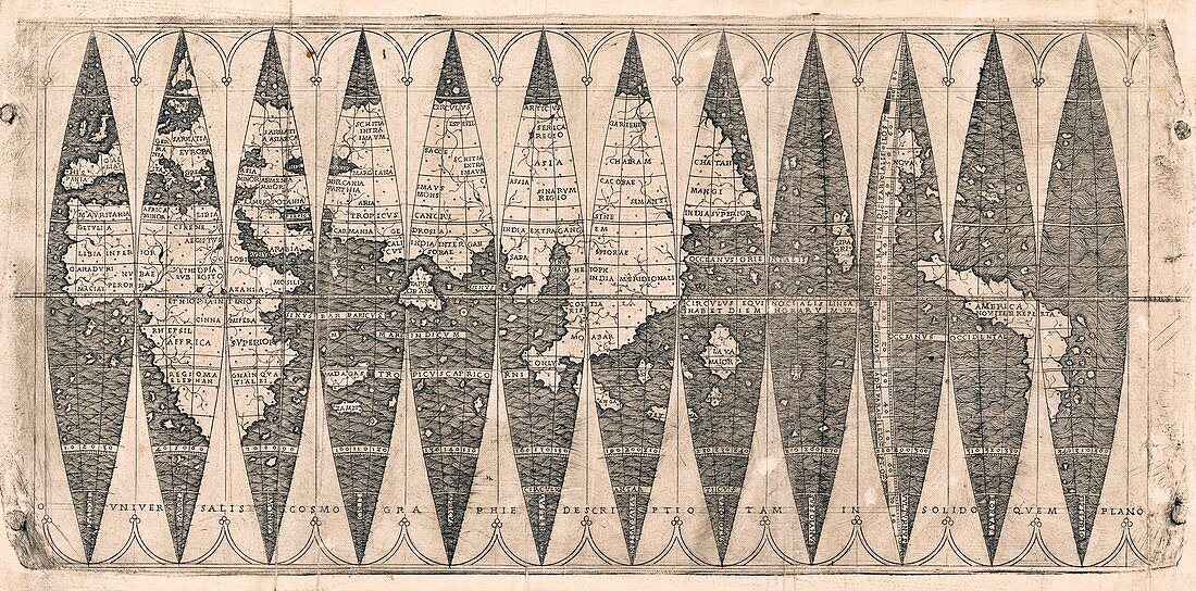
| Tross map gores. 16th-century set of 12 map gores showing the geography of the Earth, found inserted into an atlas by German cartographer Martin Waldseemuller (c.1470-1520). Map gores were intended to be placed on a globe to produce a three-dimensional world map. It is thought that these gores were produced by Louis Boulengier of Albi. The original Waldseemuller gores of 1507 contained the first use of the name America (lower right) to refer to the New World. The map title is in Latin across bottom: Universalis cosmographie descriptio tam in solido quem plano. | |
| Licence : | Droits gérés |
| Crédit: | Science Photo Library / NEW YORK PUBLIC LIBRARY / Rare Book Division |
| Taille de l’image : | 6545 px × 3236 px |
| Model Release : | Non requis |
| Property Release : | Non requis |
| Restrictions : | - |
Prix pour cette image À partir de 45 €
Produit vendu
(Calendrier, Carte postale, Carte de vœux, Impression sur textile, Packaging etc)
À partir de 45 €
Usage commercial
(Affichage, Annonce presse, Annonce TV, Carte, Digital - hors rés. sociaux, Digital - rés. sociaux etc)
À partir de 45 €
Éditorial
(Digital, Journal, Livre, Livre pratique, Magazine, Télévision etc)
À partir de 60 €
Usage non-commercial
(Digital - hors rés. sociaux, Digital - rés. sociaux etc)
À partir de 120 €
Mots clés
- 1500,
- 1517,
- 16ème siècle,
- allemand,
- Amérique,
- Amériques,
- aucun,
- carte,
- cartographie,
- COSMOGRAPHIA,
- européen,
- français,
- géographie,
- géographique,
- germanique,
- gore,
- histoire,
- historique,
- latin,
- livre,
- Martin Waldseemuller,
- monochrome,
- n/b,
- noir et blanc,
- noir-et-blanc,
- nom,
- nomenclature,
- nommer,
- page,
- personne,
- planète,
- projection,
- publication,
- terre,
- XVIème siècle