Map of the Arctic, 16th century
Numéro d’image : 12450064
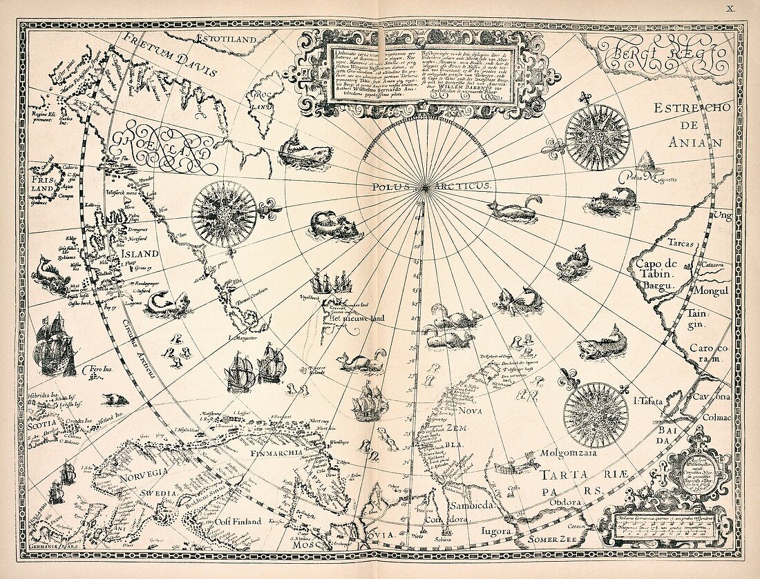
| Map of the Arctic. 16th-century map of polar countries based on explorations by Dutch cartographer and Arctic explorer Willem Barentsz (c.1550-1597). Northern Europe is across bottom, with Greenland at upper left, and northern Russia at right. Sea monsters are shown in the unknown regions round the North Pole. The furthest exploration north at the time had been achieved at Novaya Zemlya (lower right) in June 1596 by a party led by Barentsz who died on the return journey. This map was produced in 1598, with this copy reprinted in 'Materialy po istorii russkoi kartografii' (1899) by Veniamin A. Kordt (1860-1934). Barentsz is named in Latin and Dutch at upper centre. The cartouche at bottom right names the cartographers Cornelius Nicolai and Baptista van Deutecum. | |
| Licence : | Droits gérés |
| Crédit: | Science Photo Library / NEW YORK PUBLIC LIBRARY / Slavic and East European Collections |
| Taille de l’image : | 5048 px × 3850 px |
| Model Release : | Non requis |
| Property Release : | Non requis |
| Restrictions : | - |
Prix pour cette image À partir de 45 €
Produit vendu
(Calendrier, Carte postale, Carte de vœux, Impression sur textile, Packaging etc)
À partir de 45 €
Usage commercial
(Affichage, Annonce presse, Annonce TV, Carte, Digital - hors rés. sociaux, Digital - rés. sociaux etc)
À partir de 45 €
Éditorial
(Digital, Journal, Livre, Livre pratique, Magazine, Télévision etc)
À partir de 60 €
Usage non-commercial
(Digital - hors rés. sociaux, Digital - rés. sociaux etc)
À partir de 120 €
Mots clés
- 1500,
- 1596,
- 1598,
- 16ème siècle,
- 1800,
- 1899,
- 19ème siècle,
- années 1800,
- Arctique,
- aucun,
- BAPTISTA A DOETECBUM,
- BAPTISTA VAN DEUTECUM,
- carte,
- cartographie,
- cartographique,
- CORNELIUS NICOLAI,
- du nord,
- européen,
- exploration,
- géographie,
- géographique,
- histoire,
- historique,
- illustration,
- latin,
- livre,
- néerlandais,
- oeuvre,
- page,
- personne,
- Pôle Nord,
- publication,
- région polaire,
- spetentrional,
- XIXème siècle,
- XVIème siècle