Erupting El Chichon volcano, Mexico
Numéro d’image : 12334822
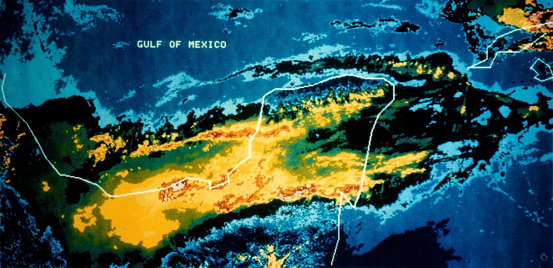
| NOAA-7 satellite image of the area around the erupting El Chichon volcano, Yucatan, Mexico, taken on 29th March 1982, 1 day after the eruption began. An infra-red sensor onboard the satellite records the temperature distribution over the area, producing a colour-coded image. The eruption (& subsequent ones on 3rd & 4th April 1982) destroyed about 100 square kilometres of rainforest, sending a sulphur- laden plume of ash 17 kilometres into the atmosphere. During the following weeks a cloud of sulphuric acid vapour encircled the Earth, apparently affecting global weather patterns. | |
| Licence : | Droits gérés |
| Crédit: | Science Photo Library / NOAA |
| Taille de l’image : | 6098 px × 2956 px |
| Model Release : | Non requis |
| Property Release : | Non requis |
| Restrictions : | - |
Prix pour cette image À partir de 45 €
Produit vendu
(Calendrier, Carte postale, Carte de vœux, Impression sur textile, Packaging etc)
À partir de 45 €
Usage commercial
(Affichage, Annonce presse, Annonce TV, Carte, Digital - hors rés. sociaux, Digital - rés. sociaux etc)
À partir de 45 €
Éditorial
(Digital, Journal, Livre, Livre pratique, Magazine, Télévision etc)
À partir de 60 €
Usage non-commercial
(Digital - hors rés. sociaux, Digital - rés. sociaux etc)
À partir de 120 €