LANDSAT image of Anti-Atlas mountains, Morocco
Numéro d’image : 12258031
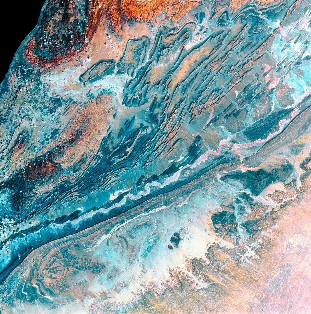
| Anti-Atlas mountains. Coloured LANDSAT satellite image of the Anti-Atlas mountains in Morocco, Africa. North is at top. Green vegetation is coloured red. The geology is dominated by the folded Anti-Atlas mountain range (upper centre) running in lines as ridges of resistant rock, with water eroded valleys. The Anti-Atlas range was formed by movement, folding and uplifting at the boundary of the African and Eurasian tectonic plates, although this boundary is fairly static now. Running from bottom left to right is the long ridge of Jbel Ouarkziz. The Atlantic ocean is at top left. Photographed in November. | |
| Licence : | Droits gérés |
| Crédit: | Science Photo Library / MDA Information Systems |
| Taille de l’image : | 4219 px × 4269 px |
| Model Release : | Non requis |
| Property Release : | Non requis |
| Restrictions : | - |
Prix pour cette image À partir de 45 €
Produit vendu
(Calendrier, Carte postale, Carte de vœux, Impression sur textile, Packaging etc)
À partir de 45 €
Usage commercial
(Affichage, Annonce presse, Annonce TV, Carte, Digital - hors rés. sociaux, Digital - rés. sociaux etc)
À partir de 45 €
Éditorial
(Digital, Journal, Livre, Livre pratique, Magazine, Télévision etc)
À partir de 60 €
Usage non-commercial
(Digital - hors rés. sociaux, Digital - rés. sociaux etc)
À partir de 120 €