Chicago from space
Numéro d’image : 12058911
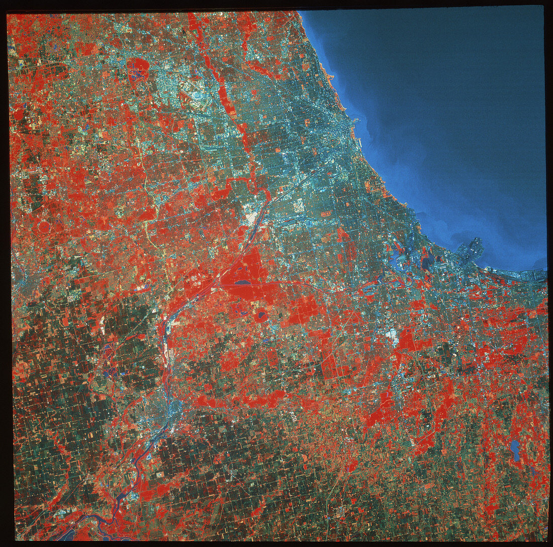
| Chicago. Infrared satellite image of the city of Chicago in Illinois,USA. North is at top. In the infrared range water is dark blue/black,green vegetation is red,agricultural areas are yellow or dark green and buildings are light blue. Chicago stands on the shore of Lake Michigan. At upper left is O'Hare International Airport,one of the world's busiest. Chicago is also an important rail and road haulage centre,as well as beng a major port. Image taken by the American Landsat-5 satellite in June | |
| Licence : | Droits gérés |
| Crédit: | Science Photo Library / Terranova International |
| Taille de l’image : | 3942 px × 3896 px |
| Model Release : | Non requis |
| Property Release : | Non requis |
| Restrictions : |
|
Prix pour cette image À partir de 45 €
Produit vendu
(Calendrier, Carte postale, Carte de vœux, Impression sur textile, Packaging etc)
À partir de 45 €
Usage commercial
(Affichage, Annonce presse, Annonce TV, Carte, Digital - hors rés. sociaux, Digital - rés. sociaux etc)
À partir de 45 €
Éditorial
(Digital, Journal, Livre, Livre pratique, Magazine, Télévision etc)
À partir de 60 €
Usage non-commercial
(Digital - hors rés. sociaux, Digital - rés. sociaux etc)
À partir de 120 €