New York City from space
Numéro d’image : 12058909
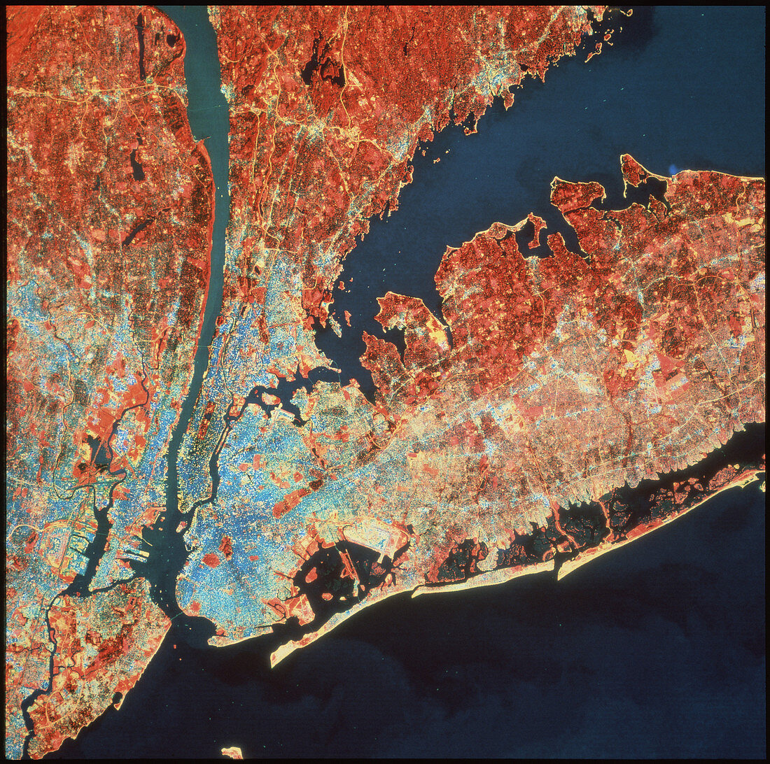
| New York. Infrared satellite image of New York City,USA. North is at top. In the infrared range water is black,green vegetation is red,bare ground is yellow and buildings are light blue. The islands of Long Island (centre right),Staten Island (bottom left) and Manhattan (centre left) are visible. Central Park is visible as a red rectangle on Manhattan Island. The Hudson river flows from top left into New York Bay at lower left. Numerous bridges span the waterways between the islands. Image taken by the American Landsat-5 satellite | |
| Licence : | Droits gérés |
| Crédit: | Science Photo Library / Terranova International |
| Taille de l’image : | 3835 px × 3807 px |
| Model Release : | Non requis |
| Property Release : | Non requis |
| Restrictions : |
|
Prix pour cette image À partir de 45 €
Produit vendu
(Calendrier, Carte postale, Carte de vœux, Impression sur textile, Packaging etc)
À partir de 45 €
Usage commercial
(Affichage, Annonce presse, Annonce TV, Carte, Digital - hors rés. sociaux, Digital - rés. sociaux etc)
À partir de 45 €
Éditorial
(Digital, Journal, Livre, Livre pratique, Magazine, Télévision etc)
À partir de 60 €
Usage non-commercial
(Digital - hors rés. sociaux, Digital - rés. sociaux etc)
À partir de 120 €