Korean world map,17th-18th century
Numéro d’image : 12013756
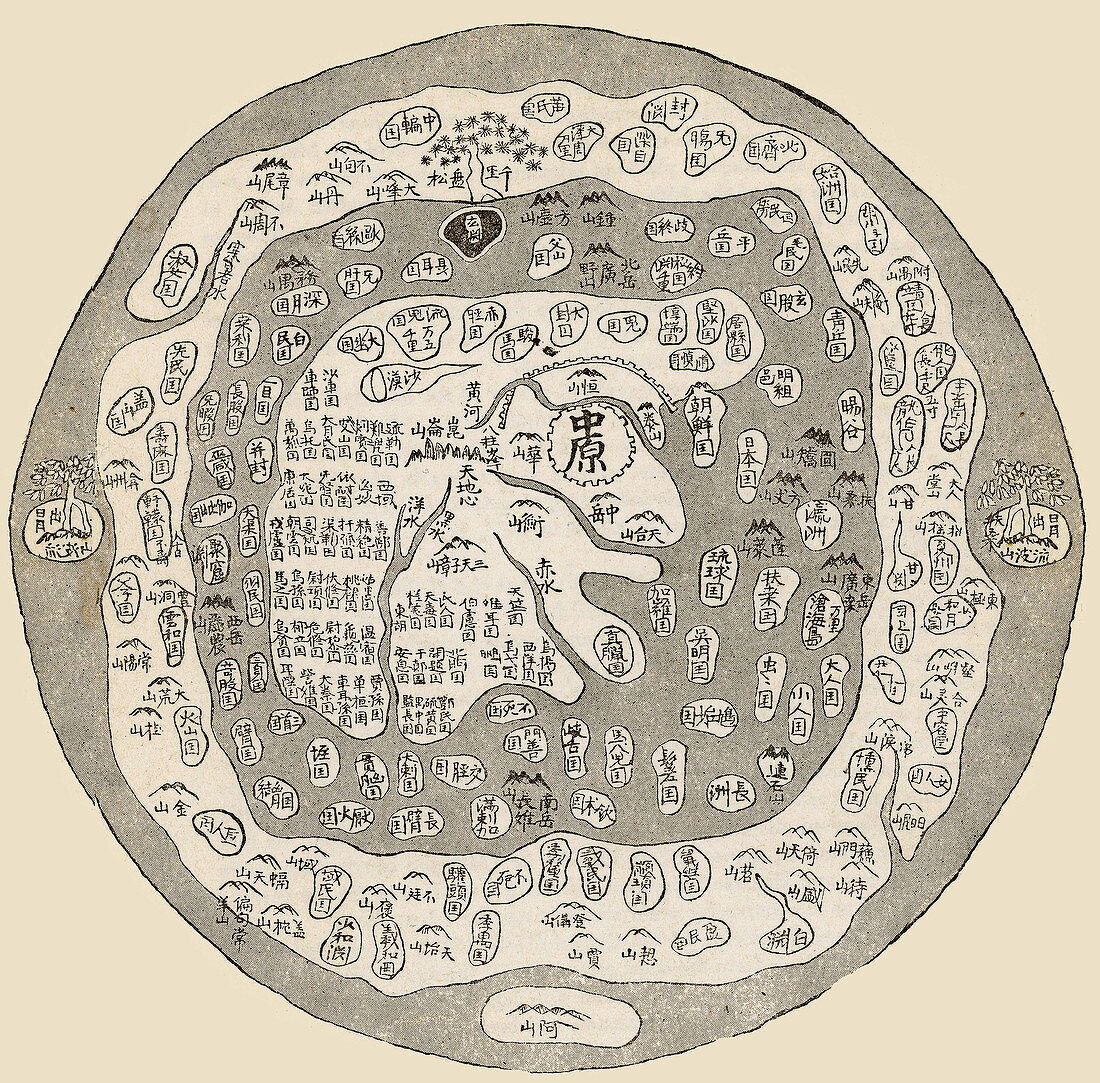
| Korean world map,17th-18th century. Known as Chonhado (World Map),the form and circular shape of such Korean maps were largely unchanged from the earliest known examples in the 16th century. The main features were an internal continent surrounded by a sea,with an external continent and sea around the edge. The names and descriptions of places (such as mountains and rivers) would include references to the religious philosophy of Taoism | |
| Licence : | Droits gérés |
| Crédit: | Science Photo Library / NYPL / Science Source |
| Taille de l’image : | 3514 px × 3460 px |
| Model Release : | Non requis |
| Property Release : | Non requis |
| Restrictions : |
|
Prix pour cette image À partir de 45 €
Produit vendu
(Calendrier, Carte postale, Carte de vœux, Impression sur textile, Packaging etc)
À partir de 45 €
Usage commercial
(Affichage, Annonce presse, Annonce TV, Carte, Digital - hors rés. sociaux, Digital - rés. sociaux etc)
À partir de 45 €
Éditorial
(Digital, Journal, Livre, Livre pratique, Magazine, Télévision etc)
À partir de 60 €
Usage non-commercial
(Digital - hors rés. sociaux, Digital - rés. sociaux etc)
À partir de 120 €