Tornado Outbreak In Southern U.S
Numéro d’image : 12000650
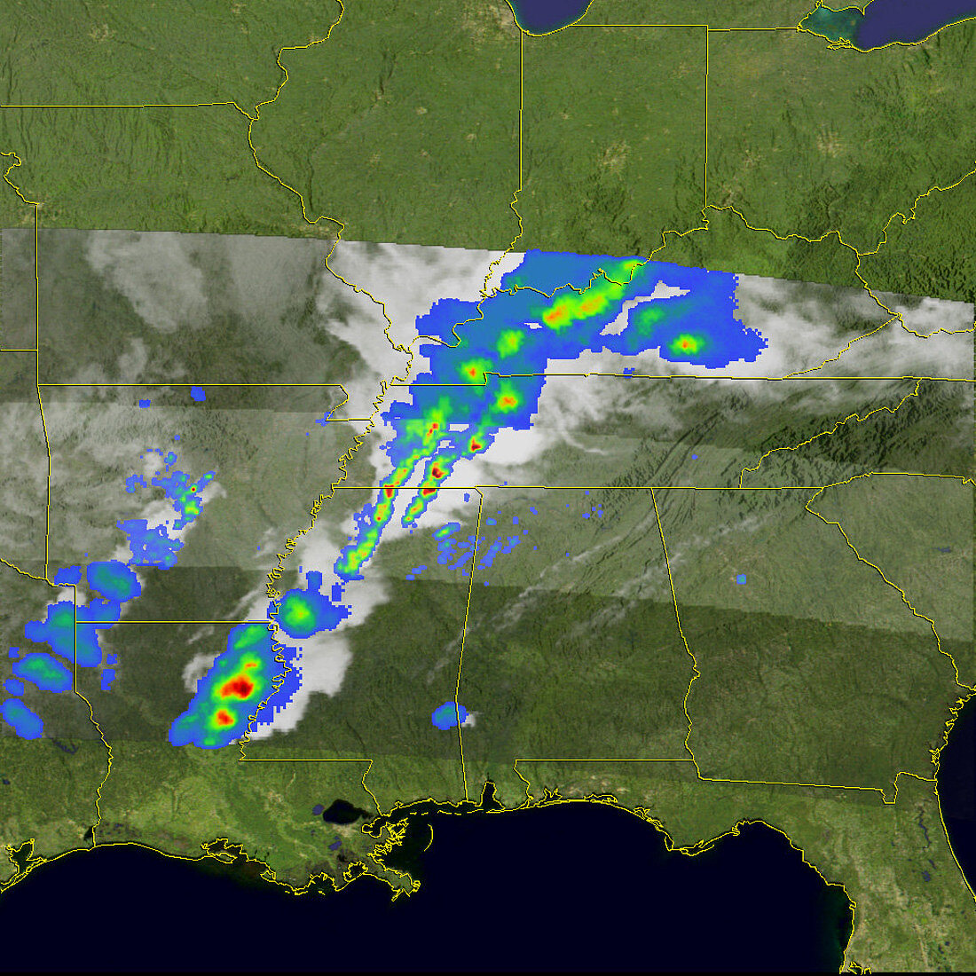
| A major wintertime tornado outbreak ripped through Arkansas,western Tennessee,northern Mississippi,northern Alabama,and western Kentucky on February 5,2008. By the afternoon of the next day,at least 52 fatalities had been reported,said news reports. At least 26 people were reported to have died in Tennessee alone. The tornadoes were spawned from a line of severe thunderstorms that moved eastward across the region. The Tropical Rainfall Measuring Mission satellite (TRMM) captured these unique images of the line of severe storms. The images were taken at 11:08 p.m. Central Daylight Time on February 5,(05:08 UTC on February 6) as the storms moved out of the lower Mississippi valley into the Ohio and Tennessee valleys. The first image shows the horizontal distribution of rain intensity as seen from above. A line of intense rainfall (darker reds) associated with the heavier thunderstorms stretches from northeastern Louisiana up through Mississippi,western Tennessee and Kentucky,and into southern Indiana. The northern part of the line contains a broader area of light to moderate rain (green and blue areas). The rain rates shown | |
| Licence : | Droits gérés |
| Crédit: | Science Photo Library / Science Source |
| Taille de l’image : | 1024 px × 1024 px |
| Model Release : | Non requis |
| Property Release : | Non requis |
| Restrictions : |
|
Prix pour cette image À partir de 45 €
Produit vendu
(Calendrier, Carte postale, Carte de vœux, Impression sur textile, Packaging etc)
À partir de 45 €
Usage commercial
(Affichage, Annonce presse, Annonce TV, Carte, Digital - hors rés. sociaux, Digital - rés. sociaux etc)
À partir de 45 €
Éditorial
(Digital, Journal, Livre, Livre pratique, Magazine, Télévision etc)
À partir de 60 €
Usage non-commercial
(Digital - hors rés. sociaux, Digital - rés. sociaux etc)
À partir de 120 €
Mots clés
- Alabama,
- américain,
- Amérique,
- ARKANSAS,
- austral,
- averse,
- carte,
- chute de pluie,
- du sud,
- environnement,
- environnemental,
- Etats-Unis,
- États-Unis,
- États-Unis d'Amérique,
- infrarouge,
- inhabituel,
- Kentucky,
- météorologie,
- météorologique,
- micro-ondes,
- Mississippi,
- orage,
- orages,
- peu commun,
- précipitation,
- satellite,
- Sud,
- tempête,
- tempêtes,
- Tennessee,
- tornade,
- tornades,
- USA