Map of Ancient Gaul,19th century
Numéro d’image : 11946674
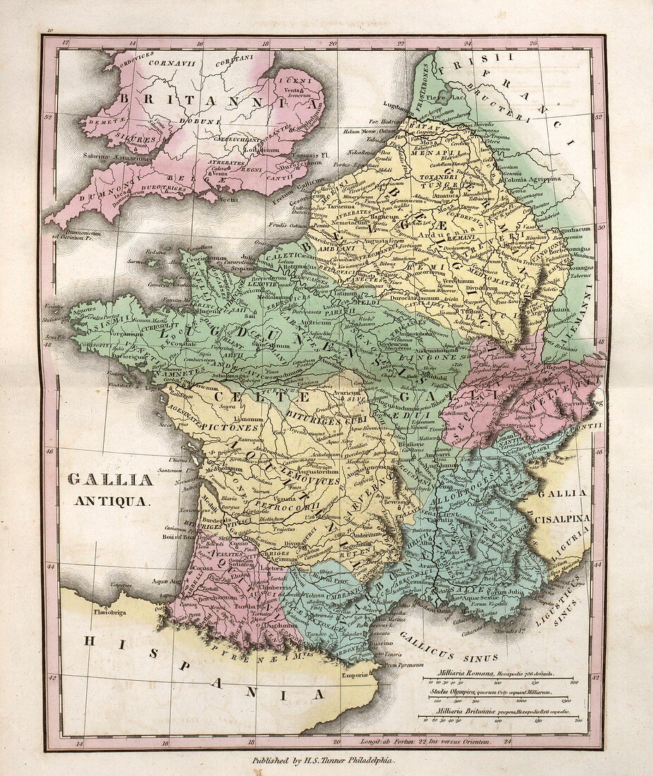
| Map of Ancient Gaul,19th century. This map of Ancient Gaul (Latin: Gallia) shows what is now mostly France. The map is divided by colour into regions such as Gallia Belgica (yellow),Gallia Lugdunensis (green),Gallia Aquitania (yellow) and Gallia Narbonensis (blue). Also named are many Celtic and non-Celtic tribes,such as the Belgae,Pictones,Bituriges,Aedui,Aquitani,Sequani,and Helvetii. The distance scales (lower right) are in Roman miles,Greek stadia,and British miles. Published in 'An Atlas of Ancient Geography' (1826) by US cartographer Henry Schenck Tanner (1786-1858) | |
| Licence : | Droits gérés |
| Crédit: | Science Photo Library / LIBRARY OF CONGRESS, Geography and Map Division |
| Taille de l’image : | 3846 px × 4574 px |
| Model Release : | Non requis |
| Property Release : | Non requis |
| Restrictions : | - |
Prix pour cette image À partir de 45 €
Produit vendu
(Calendrier, Carte postale, Carte de vœux, Impression sur textile, Packaging etc)
À partir de 45 €
Usage commercial
(Affichage, Annonce presse, Annonce TV, Carte, Digital - hors rés. sociaux, Digital - rés. sociaux etc)
À partir de 45 €
Éditorial
(Digital, Journal, Livre, Livre pratique, Magazine, Télévision etc)
À partir de 60 €
Usage non-commercial
(Digital - hors rés. sociaux, Digital - rés. sociaux etc)
À partir de 120 €
Mots clés
- 1800,
- 1826,
- 19ème siècle,
- ancien monde,
- années 1800,
- antiquité,
- atlas,
- aucun,
- carte,
- cartographie,
- celtique,
- classique,
- échelles,
- empire romain,
- GALLIA ANTIQUA,
- GALLIA AQUITANIA,
- GALLIA BELGICA,
- GALLIA LUGDUNENSIS,
- GALLIA NARBONENSIS,
- gallique,
- gaulois,
- géographie,
- géographique,
- HENRY SCHENCK TANNER,
- histoire,
- historique,
- illustration,
- impérial,
- latin,
- livre,
- monde antique,
- oeuvre,
- page,
- personne,
- province,
- publication,
- SEQUANI,
- tribus,
- XIXème siècle