Southern celestial map
Numéro d’image : 11904975
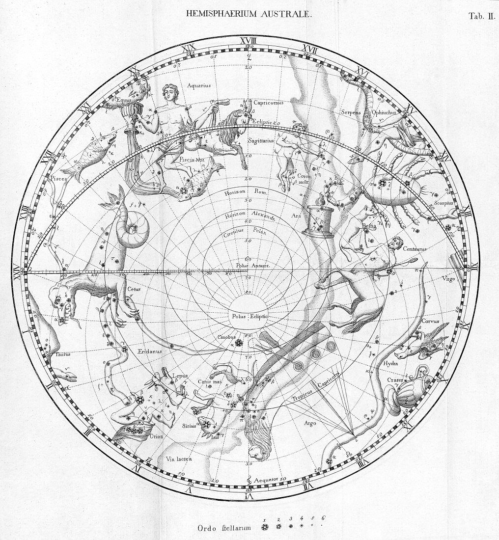
| Southern celestial map. Historical map of the sky of the southern hemisphere,showing the stars and mythological drawings of the constellations. This map is centred on the geographic south pole,with the plane of the ecliptic (arching through upper centre) showing the constellations of the southern zodiac. The zodiac shows the Sun's passage through the sky throughout the year,and does not align to the geographic equator because the Earth is tilted on its axis. The relative brightness of the stars is shown,as well as the Milky Way. Map published in Germany in 1795 | |
| Licence : | Droits gérés |
| Crédit: | Science Photo Library / New York Public Library / Science, Industry & Business Library |
| Taille de l’image : | 3240 px × 3508 px |
| Model Release : | Non requis |
| Property Release : | Non requis |
| Restrictions : | - |
Prix pour cette image À partir de 45 €
Produit vendu
(Calendrier, Carte postale, Carte de vœux, Impression sur textile, Packaging etc)
À partir de 45 €
Usage commercial
(Affichage, Annonce presse, Annonce TV, Carte, Digital - hors rés. sociaux, Digital - rés. sociaux etc)
À partir de 45 €
Éditorial
(Digital, Journal, Livre, Livre pratique, Magazine, Télévision etc)
À partir de 60 €
Usage non-commercial
(Digital - hors rés. sociaux, Digital - rés. sociaux etc)
À partir de 120 €
Mots clés
- 18ème siècle,
- Allemagne,
- allemand,
- astrologie,
- astrologique,
- astronomie,
- astronomique,
- austral,
- carte,
- céleste,
- ciel,
- constellation,
- constellations,
- dix-huitième,
- du sud,
- écliptique,
- espace,
- étoile,
- étoiles,
- germanique,
- hémisphère,
- histoire de la science,
- historique,
- illustration,
- monochrome,
- mythologie,
- mythologique,
- n/b,
- noir et blanc,
- noir-et-blanc,
- nuit,
- oeuvre,
- univers,
- XVIIIème siècle,
- zodiacal,
- zodiaque