Halley's map of the shadow of an eclipse over UK
Numéro d’image : 11904915
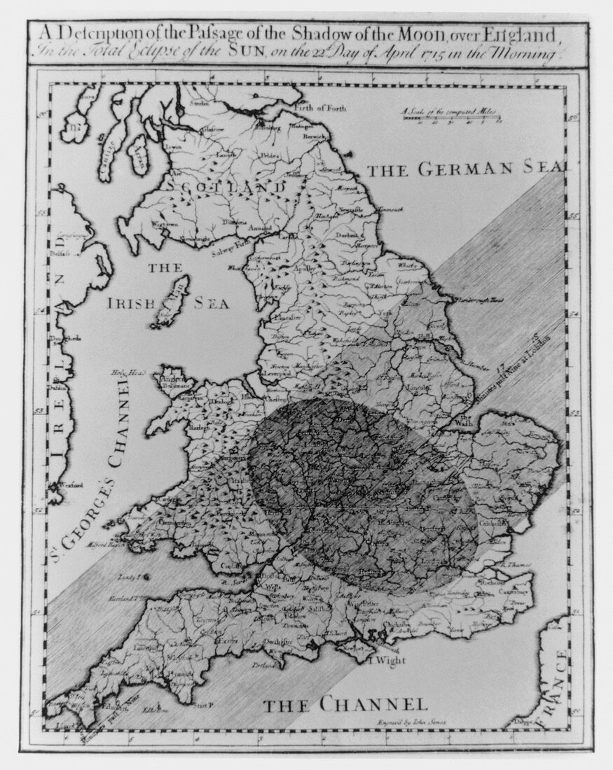
| Map of England,showing the eclipse of 1715. A map of England drawn by Edmund Halley (1656-1742),showing the passage of the shadow of the moon during the total solar eclipse of 22 April 1715. The dark circle gives the size of the moon's shadow at a given time during the eclipse; the diagonal stripe shows locations from which totality was observed. Halley was a gifted astronomer and physicist,advancing both sciences considerably. He served as Clerk & Editor of the Royal Society (ensuring the publication of Newton's Principia),and was appointed Astronomer Royal in 1720. He is most famous for predicting the return of a comet,later named after him | |
| Licence : | Droits gérés |
| Crédit: | Science Photo Library |
| Taille de l’image : | 3807 px × 4788 px |
| Model Release : | Non requis |
| Property Release : | Non requis |
| Restrictions : | - |
Prix pour cette image À partir de 45 €
Produit vendu
(Calendrier, Carte postale, Carte de vœux, Impression sur textile, Packaging etc)
À partir de 45 €
Usage commercial
(Affichage, Annonce presse, Annonce TV, Carte, Digital - hors rés. sociaux, Digital - rés. sociaux etc)
À partir de 45 €
Éditorial
(Digital, Journal, Livre, Livre pratique, Magazine, Télévision etc)
À partir de 60 €
Usage non-commercial
(Digital - hors rés. sociaux, Digital - rés. sociaux etc)
À partir de 120 €