Diagram of magnetic dip on Earth
Numéro d’image : 11904725
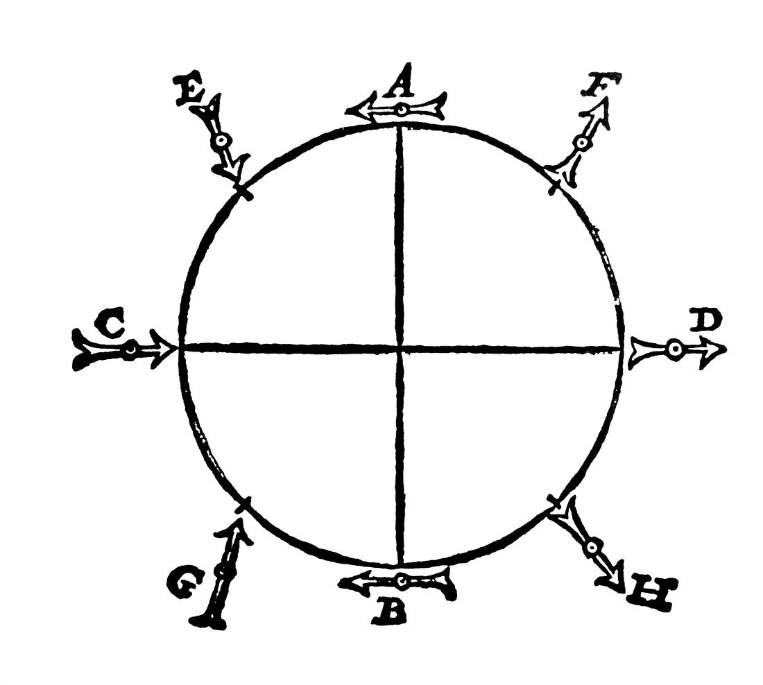
| Diagram of the Earth's magnetic field. Engraving showing the dip of the Earth's magnetic field at various latitudes,after the work of William Gilbert (1540-1603). In this picture,line AB is the equator,C is the North Magnetic Pole (Arctic) and D the South Magnetic Pole (Antarctic). The tip of the arrows are magnetic south,and the direction of the arrows indicates the direction a freely-rotating compass would point. To test the hypothesis,Gilbert used a special round lodestone called a terrela | |
| Licence : | Droits gérés |
| Crédit: | Science Photo Library |
| Taille de l’image : | 4488 px × 4031 px |
| Model Release : | Non requis |
| Property Release : | Non requis |
| Restrictions : | - |
Prix pour cette image À partir de 45 €
Produit vendu
(Calendrier, Carte postale, Carte de vœux, Impression sur textile, Packaging etc)
À partir de 45 €
Usage commercial
(Affichage, Annonce presse, Annonce TV, Carte, Digital - hors rés. sociaux, Digital - rés. sociaux etc)
À partir de 45 €
Éditorial
(Digital, Journal, Livre, Livre pratique, Magazine, Télévision etc)
À partir de 60 €
Usage non-commercial
(Digital - hors rés. sociaux, Digital - rés. sociaux etc)
À partir de 120 €