Martian rock layers
Numéro d’image : 11882280
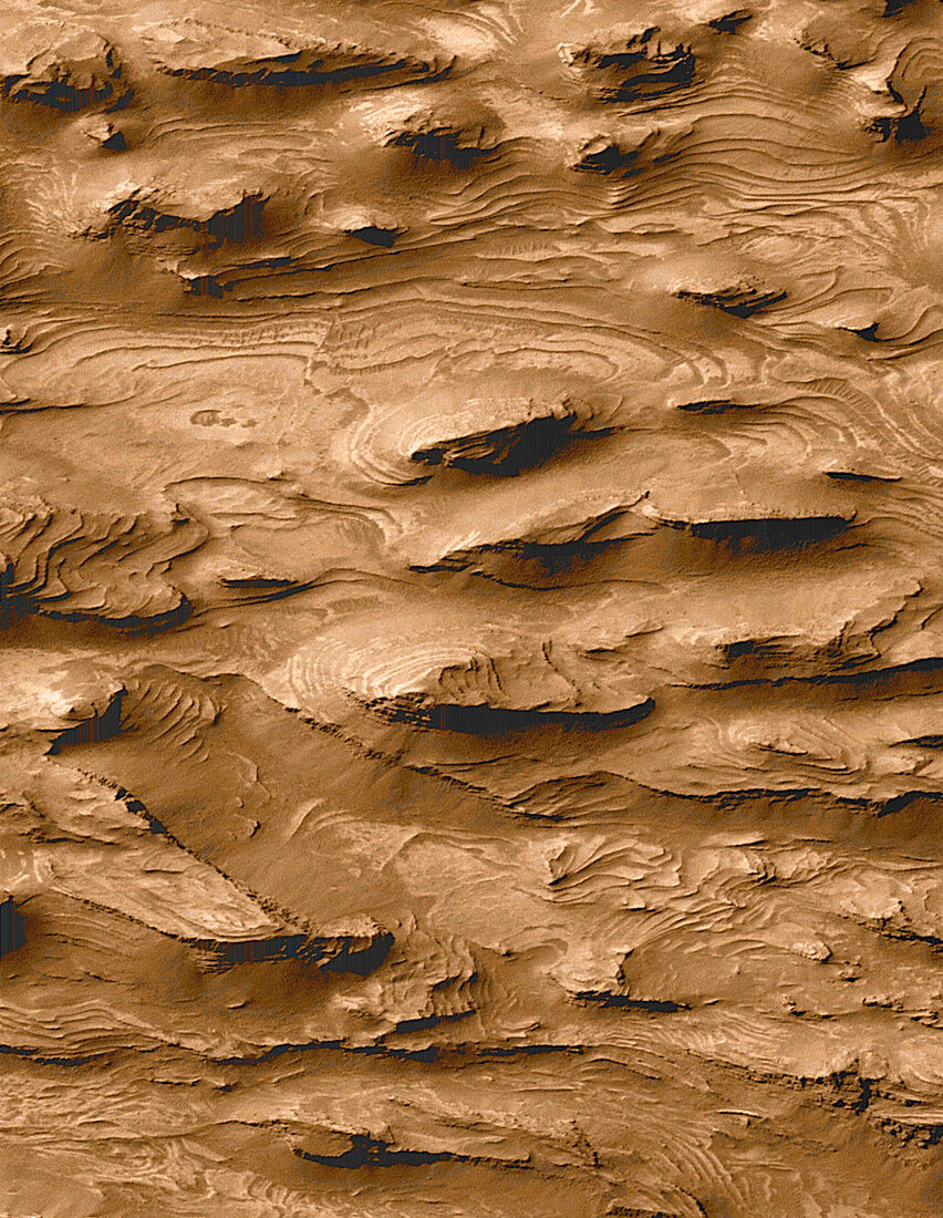
| Martian rock layers. Layered sedimentary rock terrain on the surface of Mars,thought to indicate the presence of surface water in the planet's history. Rocks such as this are formed by deposition at regular intervals. On Earth,this occurs in energetic underwater environments,implying that a lake or sea may once have covered this area. Water on Mars could have formed a habitat for life,and the area may hold fossils. This terrain is in the southern part of Candor Chasma,a valley system on Mars. This image,measuring 1.5x2.9 kilometres,was taken by the Mars Orbiter Camera on the Mars Global Surveyor spacecraft orbiting Mars. Data analysed in 2000 | |
| Licence : | Droits gérés |
| Crédit: | Science Photo Library / NASA |
| Taille de l’image : | 1024 px × 1322 px |
| Model Release : | Non requis |
| Property Release : | Non requis |
| Restrictions : | - |
Prix pour cette image À partir de 45 €
Produit vendu
(Calendrier, Carte postale, Carte de vœux, Impression sur textile, Packaging etc)
À partir de 45 €
Usage commercial
(Affichage, Annonce presse, Annonce TV, Carte, Digital - hors rés. sociaux, Digital - rés. sociaux etc)
À partir de 45 €
Éditorial
(Digital, Journal, Livre, Livre pratique, Magazine, Télévision etc)
À partir de 60 €
Usage non-commercial
(Digital - hors rés. sociaux, Digital - rés. sociaux etc)
À partir de 120 €