Mosaic image of a cratered region on Mars
Numéro d’image : 11882247
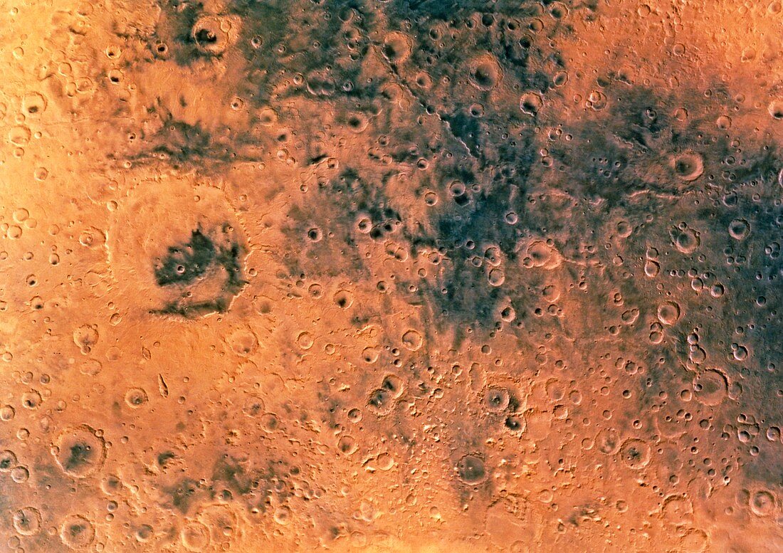
| Mars. Mosaic of images collected by the Viking I and II space probes of a region on Mars centred on 15 degrees latitude south and 305 degrees longitude. The image covers an area of 45 degrees in longitude and 30 degrees in latitude. It shows a heavily cratered region which is a typical feature of most of the southern hemisphere of the planet. Huygens at centre left,is the largest crater seen here with a diameter of about 500 km. Viking I and II were launched in August and September 1975 respectively and they both landed on the martian surface in the following year | |
| Licence : | Droits gérés |
| Crédit: | Science Photo Library / US Geological Survey |
| Taille de l’image : | 5197 px × 3669 px |
| Model Release : | Non requis |
| Property Release : | Non requis |
| Restrictions : | - |
Prix pour cette image À partir de 45 €
Produit vendu
(Calendrier, Carte postale, Carte de vœux, Impression sur textile, Packaging etc)
À partir de 45 €
Usage commercial
(Affichage, Annonce presse, Annonce TV, Carte, Digital - hors rés. sociaux, Digital - rés. sociaux etc)
À partir de 45 €
Éditorial
(Digital, Journal, Livre, Livre pratique, Magazine, Télévision etc)
À partir de 60 €
Usage non-commercial
(Digital - hors rés. sociaux, Digital - rés. sociaux etc)
À partir de 120 €