Matian south polar ice cap
Numéro d’image : 11882221
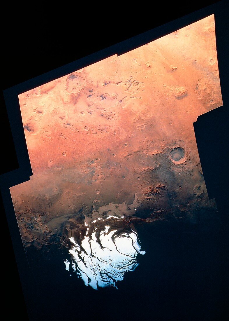
| Mosaic showing the Martian south polar ice cap,made from 24 images obtained by the Viking 2 Orbiter. The images were acquired during the Martian southern summer when the ice cap was nearing its final stage of retreat. The cap is approximately 400 km across and the exposed surface is thought to consist dominantly of carbon dioxide ice ("dry ice"). Water ice is probably present in layers underlying the south polar cap and comprising the surrounding layered terrain whose scarps can be seen illuminated in this photo. The pits with sharp-rimmed cliffs near the top of the image were prbably etched by winds. (Further information available on request) | |
| Licence : | Droits gérés |
| Crédit: | Science Photo Library / US Geological Survey |
| Taille de l’image : | 3570 px × 4996 px |
| Model Release : | Non requis |
| Property Release : | Non requis |
| Restrictions : | - |
Prix pour cette image À partir de 45 €
Produit vendu
(Calendrier, Carte postale, Carte de vœux, Impression sur textile, Packaging etc)
À partir de 45 €
Usage commercial
(Affichage, Annonce presse, Annonce TV, Carte, Digital - hors rés. sociaux, Digital - rés. sociaux etc)
À partir de 45 €
Éditorial
(Digital, Journal, Livre, Livre pratique, Magazine, Télévision etc)
À partir de 60 €
Usage non-commercial
(Digital - hors rés. sociaux, Digital - rés. sociaux etc)
À partir de 120 €