Corona on surface of Venus
Numéro d’image : 11881728
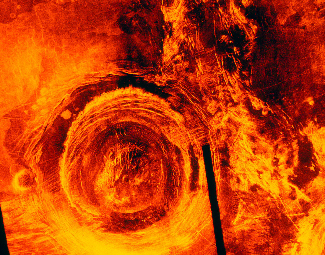
| False-colour image of a corona on the surface of Venus,made by the Magellan radar-mapping spacecraft in 1991. The corona is situated about 1000km south of the equatorial continent Aphrodite Terra. It is about 375km in diameter,and flanks a north-south trending fault zone. The corona is thought to have been produced as a result of up- swelling of the surface by molten lava,creating a dome. As the dome cools,it collapses to form the corona. Coronae are generally found on lava plains. Just to the west (left) of the corona is a later dome made of lava that has reached the surface through a fissure. The black line is an area where insufficient data were gathered | |
| Licence : | Droits gérés |
| Crédit: | Science Photo Library / NASA |
| Taille de l’image : | 3543 px × 2780 px |
| Model Release : | Non requis |
| Property Release : | Non requis |
| Restrictions : | - |
Prix pour cette image À partir de 45 €
Produit vendu
(Calendrier, Carte postale, Carte de vœux, Impression sur textile, Packaging etc)
À partir de 45 €
Usage commercial
(Affichage, Annonce presse, Annonce TV, Carte, Digital - hors rés. sociaux, Digital - rés. sociaux etc)
À partir de 45 €
Éditorial
(Digital, Journal, Livre, Livre pratique, Magazine, Télévision etc)
À partir de 60 €
Usage non-commercial
(Digital - hors rés. sociaux, Digital - rés. sociaux etc)
À partir de 120 €