Troughs in Venus surface,Lavinia Planitia
Numéro d’image : 11881710
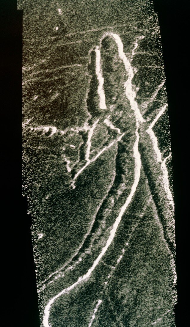
| Troughs in the surface of Venus,imaged by the Magellan radar mapping spacecraft in September 1990. The area covered by this frame is in the Lavinia Planitia region in the southern hemisphere,and is 28km wide by 75km long. The troughs are bounded by faults,probably from expansive tectonic movement of the surface. The line of pits extending west (left) just above centre suggests some volcanic activity under the surface,consistent with tectonic motion | |
| Licence : | Droits gérés |
| Crédit: | Science Photo Library / NASA |
| Taille de l’image : | 3189 px × 5486 px |
| Model Release : | Non requis |
| Property Release : | Non requis |
| Restrictions : | - |
Prix pour cette image À partir de 45 €
Produit vendu
(Calendrier, Carte postale, Carte de vœux, Impression sur textile, Packaging etc)
À partir de 45 €
Usage commercial
(Affichage, Annonce presse, Annonce TV, Carte, Digital - hors rés. sociaux, Digital - rés. sociaux etc)
À partir de 45 €
Éditorial
(Digital, Journal, Livre, Livre pratique, Magazine, Télévision etc)
À partir de 60 €
Usage non-commercial
(Digital - hors rés. sociaux, Digital - rés. sociaux etc)
À partir de 120 €