Radar image of Lakshmi Planum,Venus
Numéro d’image : 11881707
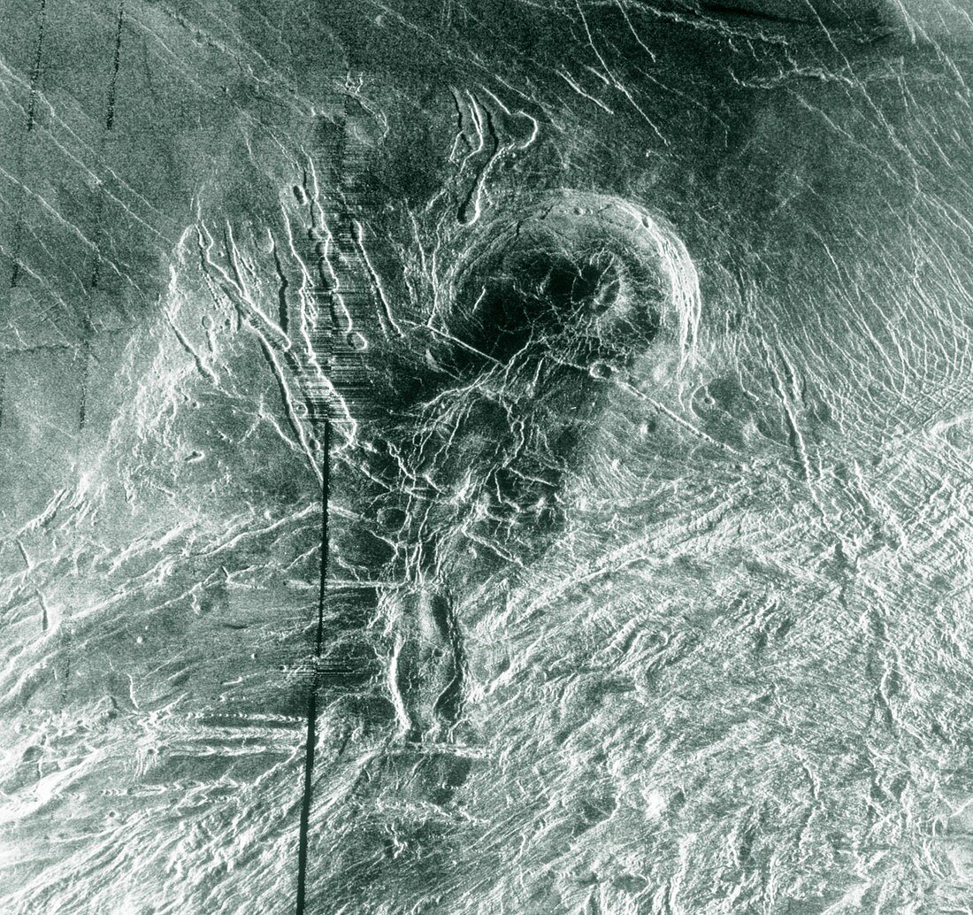
| Mosaic radar image of the surface of Venus,in the region of the Lakshmi Planum plateau. The image was made by the Magellan radar-mapping spacecraft during several successive orbits of the planet. The Lakshmi Planum plateau is the radar-smooth area at the top of the frame,with the intensely deformed terrain of the Clotho Tessera at the bottom. Just above centre is a 64km wide depression called Siddons,thought to be a volcanic caldera. This view is supported by the collapsed lava tubes surounding the feature,most clearly to the left of centre. The black vertical bands in the image are areas where no radar data were gathered | |
| Licence : | Droits gérés |
| Crédit: | Science Photo Library / NASA |
| Taille de l’image : | 4492 px × 4223 px |
| Model Release : | Non requis |
| Property Release : | Non requis |
| Restrictions : | - |
Prix pour cette image À partir de 45 €
Produit vendu
(Calendrier, Carte postale, Carte de vœux, Impression sur textile, Packaging etc)
À partir de 45 €
Usage commercial
(Affichage, Annonce presse, Annonce TV, Carte, Digital - hors rés. sociaux, Digital - rés. sociaux etc)
À partir de 45 €
Éditorial
(Digital, Journal, Livre, Livre pratique, Magazine, Télévision etc)
À partir de 60 €
Usage non-commercial
(Digital - hors rés. sociaux, Digital - rés. sociaux etc)
À partir de 120 €