Topographic map of Venusian north polar region
Numéro d’image : 11881703
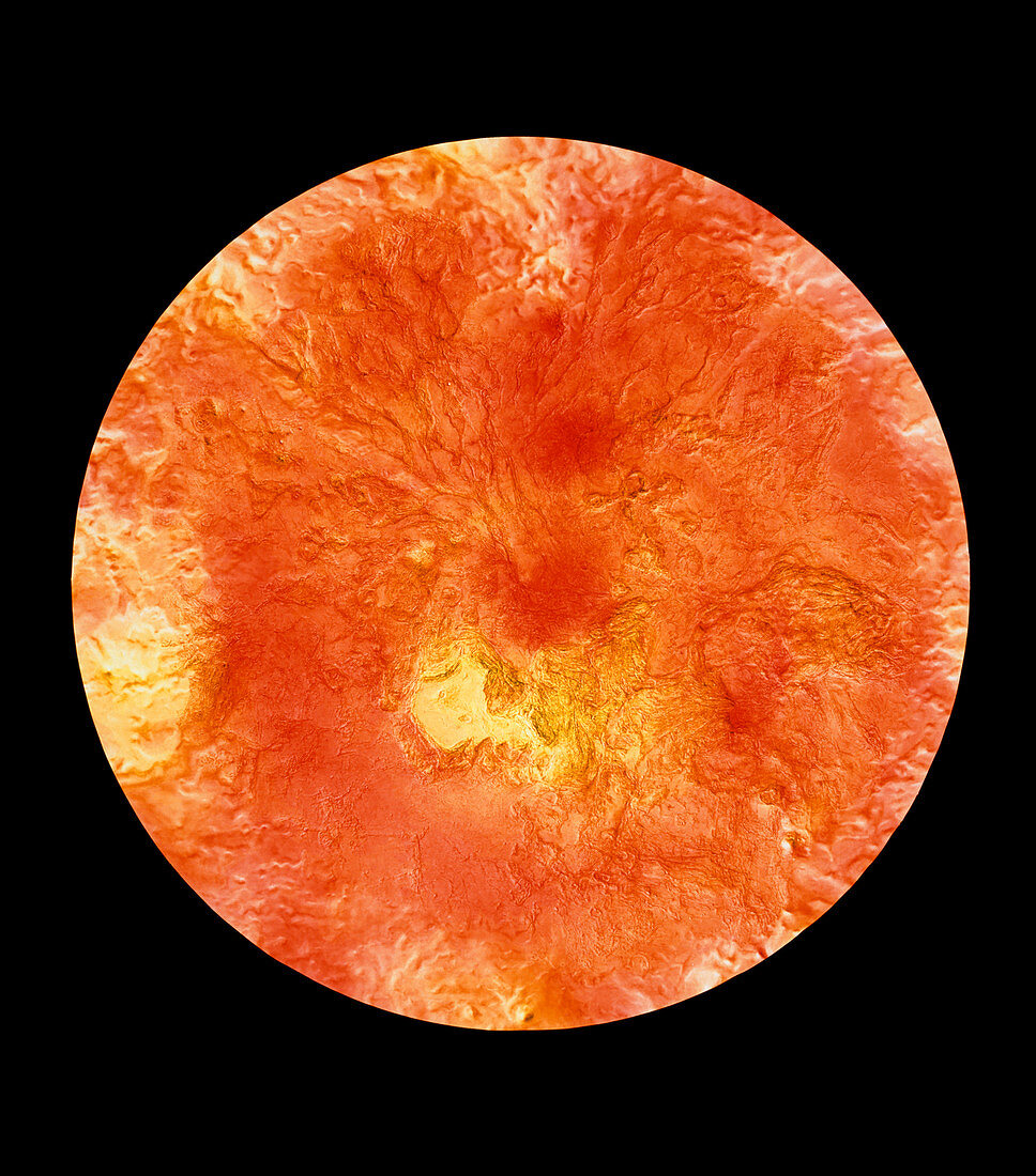
| Colour-coded topographic map of the region surrounding Venus' north pole. The view is centred on the pole and extends down to a latitude of 20 degrees north. Yellow areas represent high ground & orange areas low ground. The yellow region just below centre is Ishtar Terra and contains Lakshmi Planum (smooth area at left) and the Maxwell Montes (rough terrain at right),the highest mountains on Venus. The rope-like ridges at upper left are thought to be tectonic in origin. The map was compiled using data from the Soviet Venera 15 & 16 spacecraft,the American Pioneer Venus spacecraft and the Arecibo radio telescope in Puerto Rico | |
| Licence : | Droits gérés |
| Crédit: | Science Photo Library / NASA / US Geological Survey |
| Taille de l’image : | 4366 px × 4961 px |
| Model Release : | Non requis |
| Property Release : | Non requis |
| Restrictions : | - |
Prix pour cette image À partir de 45 €
Produit vendu
(Calendrier, Carte postale, Carte de vœux, Impression sur textile, Packaging etc)
À partir de 45 €
Usage commercial
(Affichage, Annonce presse, Annonce TV, Carte, Digital - hors rés. sociaux, Digital - rés. sociaux etc)
À partir de 45 €
Éditorial
(Digital, Journal, Livre, Livre pratique, Magazine, Télévision etc)
À partir de 60 €
Usage non-commercial
(Digital - hors rés. sociaux, Digital - rés. sociaux etc)
À partir de 120 €